Gesäuse


Gesäuse National Park
• In the province of Styria
• Youngest national park in Austria, established 2002
• Covering 6 local authority areas
• 11,306 ha in size
• Altitude varying between 490 m and 2,370 m above sea level (Mt Hochtor)
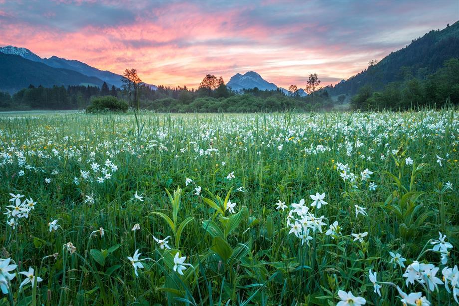
• Some 90 species of breeding birds and 50 species of orchids
• 50% forest, 31% rock walls, scree slopes and Alpine grassland, 13% dwarf pines, 5% high pastures and meadows
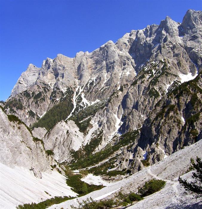
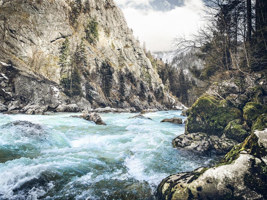
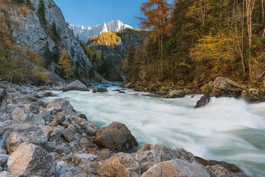
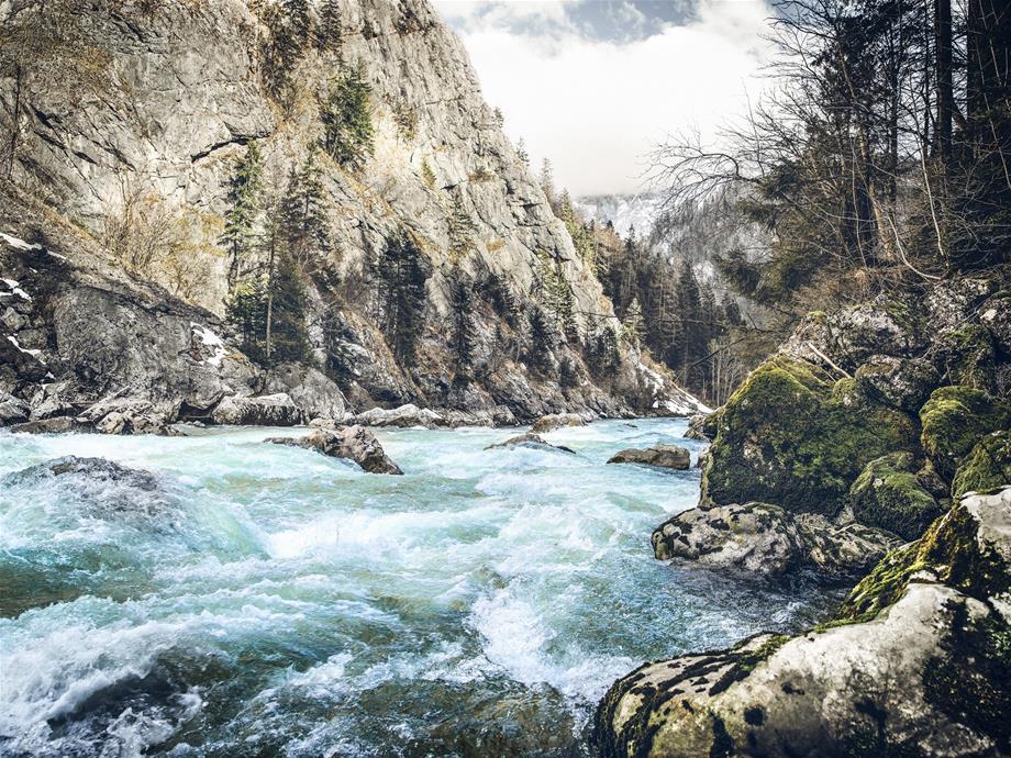
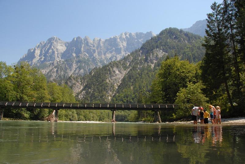
Established in 2002 and covering an area of 11,306 hectares, the Gesäuse National Park is the third-largest of the six Austrian national parks. The natural environment of this park, situated between Admont, known for its Benedictine abbey, and Hieflau, an old mining town, is 86% natural area. This landscape maintains and preserves crags, forest and the mighty, wild river Enns.
Affectionately known as "Xeis/Gseis”, this conservation area is home mostly to natural and semi-natural forests, remnants of primeval forests, wetlands and riparian forests whose conservation is being guaranteed for the future.
In addition to conservation, the improvement of habitats of endangered animal and plant species and the study of ecosystems, the main roles of this Styrian national park include recreation and environmental education. The research activities of the park are supported by universities and recognised specialists.
More information:
www.nationalpark.co.at/en


Haindlkar walk
Starting point and end point
Bus stop Weidendom or Weidendom parking area
Elevations
Weidendom 590 m, Haindlkar lodge 1,121 m, Gsengscharte 1,219 m
Walking time
Weidendom - Leier trail - Haindlkar parking area: 0.5 hours; further to the Haindlkar lodge: 1.5 hours; further to the Gsengscharte (highest point): 20 minutes; Gsengscharte - Sagen trail/Wilder John - Weidendom: 1.5 hours, total walking time approx. 3.5-4 hours
Difficulty/trail conditions
Easy to moderately difficult trails and climbs in variable terrains, terrain briefly steep in some parts after Gsengscharte (secured with steel ropes and chains), sturdy footwear required
Features
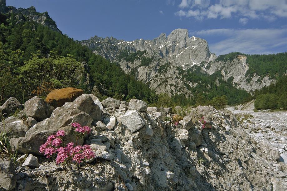
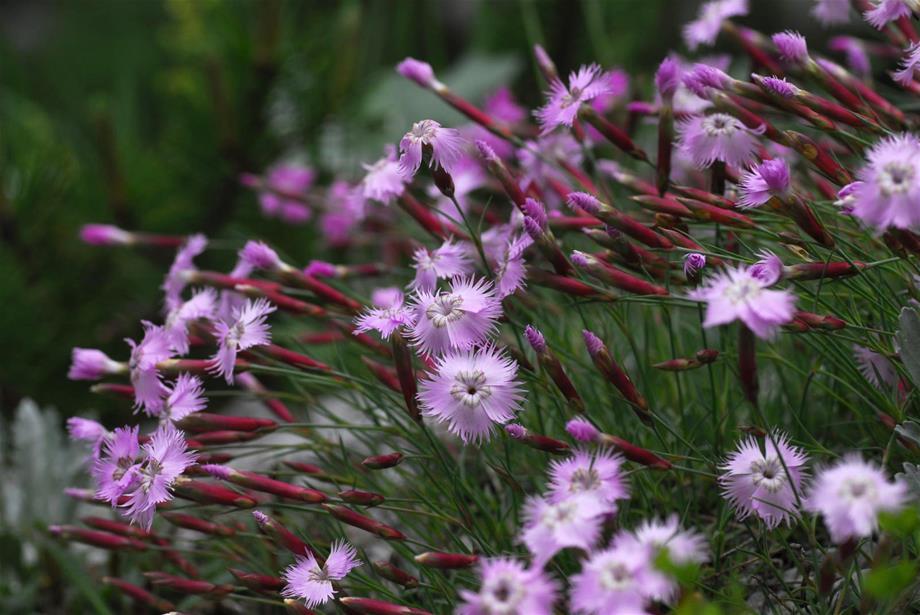
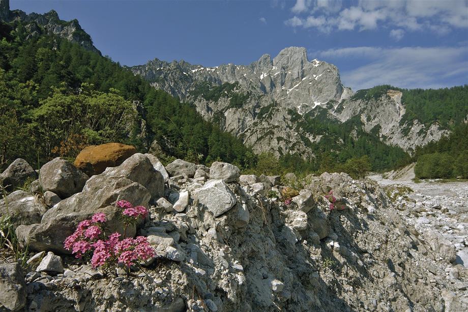
Alpine landscape, rockfall blocks, alpine salamanders, chamois, delicate clove pink, lady's slipper, Wilder John theme trail
Rest points
Haindlkar lodge, zur Bachbrücke inn (at Weidendom)
This wonderful and short tour starts at the bus stop Weidendom or at Weidendom parking area and first leads via the Leierweg along the connection path through a mixed beech forest to the Haindlkar parking area (cross 1 main road). This where the ascent to Haindlkar, trail no. 658 begins, accompanied by the fine bushes of amelanchier and purple heather. Chalk-loving rowanberries, mountain pines and scattered juniper bushes are dotted around the alpine environment, up past the quaint old Haindlkar lodge (1,080 m) to the new Haindlkar lodge (1,121 m).
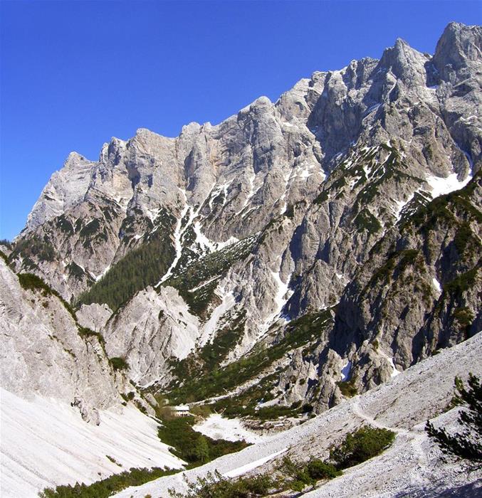
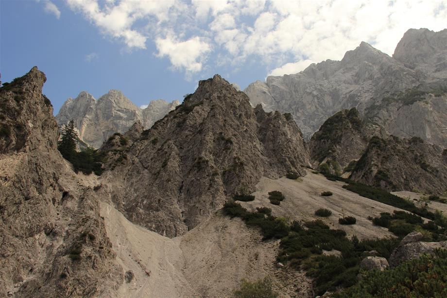
With a bit of luck, you may come across a black alpine salamander along the trail. The new Haindlkar lodge is a great place to eat and you can watch climbers conquering the Hochtor north face from the terrace (binoculars can be borrowed from the lodge). After a short refreshment, the adventure continues on trail no. 658. This first leads you through a debris flow and then through a pine field to the highest point of the trek at the Gsengscharte (1,219 m). Impressive views of the jagged rocks of the Hochtor range can be enjoyed. Even the distant Admont basin can be seen from here.
On the descent (steady footing required), the first few meters lead you over rocks that are secured with steel ropes and chains, and then down through the sunny and striking gravel field Gseng. If you take a seat further below in the secure mountain pine area, you can sense the processes that are eroding the mountain. During an attentive hike, you will catch sight of chamois every now and again or find delicate clove pink (strictly protected endemic plant) at the edge of the trail. From Fseng, you will then arrive at the Sagen trail (no. 71, 608) and turn right, heading north to the end of the themed trail Wilder John. Then you will pass through the forest and arrive at a lodge for visitor area Hellichter Stein, where you can rinse your feet in the cooling waters of Johnsbach. In spring, the largest native variety of orchid, the lady's slipper, grows along the Wilder John, which tells the story of Johnbach at various locations. A few meters after the crossing of the debris flow Humlechner Graben, you arrive at the discovery centre Weidendom (parking area, bus stop, inn).

Hartelsgraben, Sulzkaralm and Hess Lodge
Starting point
Parking area at Hartelgraben (directly by Gesäuse main road)
End point
Pub/parking area by Kölblwirt in Johnsbach
Elevations
Parking area at Hartelsgraben 521 m, Sulzkaralm 1,453 m, Sulzkarhund 1,821 m, Hess lodge 1,699 m, Johnsbach 860 m, Zinödl 2,191 m
Walking time
Hartelsgraben - Sulzkaralm - Hess lodge: approx. 5 hours Hess lodge - Johnsbach: approx. 2 hours Optionally, Hess lodge - Zinödl (ascent only!): 1.5 hours via the normal trail or 2 hours via the panorama trail
Difficulty/trail conditions
Moderately difficult trails and climbs in varying terrain, steep in parts but never exposed, sturdy footwear required
Features
Themed trail Hartelsgraben, high mountain panoramas, natural forests, biodiverse alpine landscape, marmots, larch forest
Rest points
Hess lodge, Kölblwirt (Johnsbach)
My favourite hiking route leads through the Hartelsgraben to the Sulzkaralm, and then to the Hess lodge, ending in Johsbachtal. I find this route particularly pleasant because it combines the experience of a wild forest landscape, blooming alpine pastures, alpine mountain scenery and the cosiness of a stop at an alpine hut. The first part of the route passes through the Hartelsgraben to trail no. 665 via the oldest forest road in Styria. The cool, humid air in the ravine forest is a welcome refreshment on warm summer days. The ravine forest that you pass through is a special feature, as it is one of the forest types in the area less dominated by hardwood. The history of the old forest road and past intensive charcoal smelting is illustrated along the themed trail in the Hartelsgraben.
After the long ascent along the old forest road, you reach the first pastures of the Sulzkaralm via trail 601. It captivates with its stunning alpine landscape. Tall spruces, ricks in the middle of the pastures, small bogs with cotton grass and a small lake - the Sulzarsee - are not only the habitat of a variety of plants and animals, they also inspire those who pass through them. It is easy to observe marmots or chamois on the steep flanks surrounding the mountain pasture. Cows and horses graze on the alpine pastures, the small alpine huts invite you to take a short break and refresh yourself at the spring.
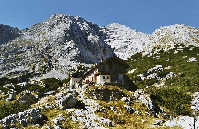
From the Sulzkaralm, you follow a steep incline to the so-called Sulzkarhund, a characteristic rock formation that resembles a dog. From the saddle, you then head downhill slightly to trail no. 601 towards Hess lodge where you can finally treat yourself to a well-deserved break. In addition to a hearty meal and a cool drink, you can take in the view of the Hochtor range and the Zinödl on the sun terrace. Sporty types have the option of climbing to the summit of the Zinödl on trail no. 662 before stopping off at the lodge. True to its name, the "panorama trail” on the Zinödl (trail no. 62) provides an impressive view of the surrounding Gesäuse summit and the landscape of the Enns valley.
It is worth going down to the valley before nightfall. Trail no. 601 to Johnsbach is the shortest and safest trail. In addition, shortly after the Hess lodge, you wander through a larch forest which boasts a yellow glow in autumn. Once you have arrived at Johnsbachtal, it is best to take a Gseispur taxi in order return to the starting point quickly and easily or to your accommodation in the area.

Rauchboden Trail
Starting point
Gstatterboden or parking area at Buchsteinhaus
End point
Weidendom discovery centre
Elevations
Parking area at Buchsteinhaus 573 m, Rauchboden 657 m (highest point), Buchsteinhaus 1,546 m, Weidendom discovery centre 590 m
Walking time
Gstatterboden - Weidendom: approx. 1.5 hours (3.5 km). Optionally, Gstatterboden - Buchsteinhaus (ascent only!): approx. 3 hours (day trip with children)
Difficulty/path conditions
Easy hike/forest road; alternative route to the Enns cycle path R7; Buchsteinhaus: moderately difficult climb on varying terrain, sturdy footwear required
Features
Magnificent views of the Hochtor and Reichenstein range, spectacular views down to the roaring Enns, natural forests, mountain bike trail, Buchsteinhaus (with sun terrace)
Rest points
Pavillon Gstatterboden National Park, Zur Bachbrücke inn/Weidendom, Buchsteinhaus
What do National Park Förster Martin Zorn and travel agency manager Isabella Mitterböck have in common? She is often drawn here with her family to hike the Rauchboden trail and sometimes, when they have a full day to spare, and taste a new delicious meal at the Buchsteinhaus. What is special about this route is the first-hand experience of all 3 distinct habitats of the national park, which are reflected in the national park logo: water, forest and rock. The starting point of the hike is the parking area at the Buchsteinhaus in Gstatterboden. After crossing the bridge over the Enns, make a left turn onto the Rauchboden trail that begins with a brief steep section. A magnificent view of the mighty Hochtor range and its highest elevation, the Hochtor standing at 2,369 m and a breathtaking view down to the booming, unspoilt Enns await you as a reward. The shaded forest that you wander through provides an ideal breeding ground and very special habitat for a variety of beings with its infested deadwood trees, which are deliberately left in a national park.
The varying ascent to the Buchsteinhaus begins in the area of an old cabbage patch (trail no. 641), passing through unspoiled forest where population transformations have already taken place. You will soon reach a debris flow (Kuhgraben), which you will cross and continue towards the Brucksattel. The last part leads to the Buchsteinhaus, which is situated at the junction between the forest and pine area at a height of 1,546 m, via a not too difficult and shaded zig-zag trail. The view of the mountains from the redesigned sun terrace and the delicious food will help you forget about your tired legs. You should not leave too late (especially with children) for this day trip and you should bring waterproof clothing, sturdy footwear and, most importantly, enough to drink - there is no water available on the trail.
Should you remain on the Rauchboden trail, then you will shortly cross a bridge that leads over the Kühgraben. Here you can marvel at the successful reforestation project of the torrent control. On the opposite side there is a magnificent view of the Haindlkar with the legendary Peternpfad, named after the poacher "Schwarzer Peter” who once committed his terrible deeds in these steep gorges. The trail gently continues at a slight ascent and with a bit of luck (if you are not too loud) you might encounter a herd of chamois refreshing themselves in the morning or evening at the spring that flows across the road. The forest road then begins to descend and the last part, before arriving at the train stop Johnsbach, is characterised by ancient forests dominated by spruce. In this area, natural regeneration and population transformation, implemented by the Styrian state forests, are underway.
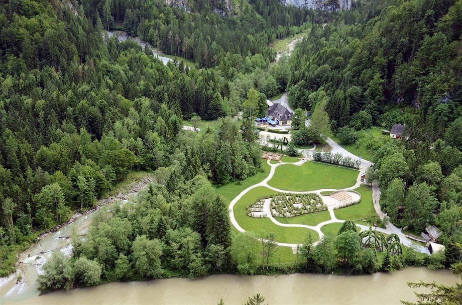
At the Johnsbach stop, there are magnificent views of Johnsbachtal and of the surrounding mountains of Gesäuse, which is especially exciting for children! Then you carefully cross the railway line and the new, wheelchair-accessible Johnsbach bridge with a wonderful viewing window overlooking the wild, booming Enns. A visit to the Weidendom discovery centre or the legendary trail "Der Wilde John”, which winds along the adventure stations to Johnsbachtal, marks the end of this eventful trip.
There are various options for returning to your car in Gstatterboden: You can either walk back along the Rauchboden trail or take a taxi from Gseispur or a public bus.
You can also now ride a mountain bike along the Rauchboden trail, to the delight of Isabella and Martin, since they not only ardent hikers, but also passionate bikers!
Travel options
Without question, the means of travel of our time is the car. And we know it. Having said that, we kindly ask our visitors to first check public transport and soft mobility options in the region and not use their own car as far as possible.
SOFT MOBILITY:
Simply arrive with the mobility platform Gseispur.
For more information on the topic of soft mobility and car-free holidays at National Park Gesäuse, please visit:
www.gseispur.at
Gesäuse National Park app (Android and iOS)
Gseispur helpline +43 3637 212
BY CAR:
At Gesäuse National Park, you can get a holiday from your own car. For example, four mountain lodges can be reached from the camp site without car.
Travelling from Vienna:
Option 1: Motorway A1 (exit Amstetten Nord), then continue to federal roads via Waidhofen/Ybbs, Weyer (B121) and Altenmarkt an der Enns, Weißenbach an der Enns, St. Gallen (B115).
Option 2: Motorway A1 exit St. Pölten Süd, then B20 (Mariazeller main road), B25 (Erlauftaler main road) and B115 (Eisen main road) to Gesäuse.
Option 3: Motorway A2, S6 and Pyhm motorway A9, then either exit Traboch and then via Präbichl and Eisenerz to Gesäuse or exit Admont-Gesäuse at Ardning.
Travelling from Graz and Linz:
Pyhm motorway A9 (exit Admont-Gesäuse) at Ardning
Travelling from Salzburg:
Tauern motorway A10 and Ennstal main road B146 via Schladming and Liezen.
Important information:
Please observe the identified parking spaces in the Gesäuse National Park region.
Road conditions and winter closure
NATIONWIDE TRAIN TRAVEL
Travelling to Gesäuse the environmentally friendly way.
Travelling from Vienna:
Option 1: Vienna Südbahnhof - Semmering - Selzthal (when travelling with GSEISHUTTLEPUR) or Liezen (when travelling with regional bus lines)
Option 2: Vienna Meidling - Westbahnstrecke - destination Kleinreifling or Weißenbach an der Enns
Option 3: On Saturdays, Sundays and public holidays, directly from/to Vienna to the Gesäuse National Park: Vienna - Amstetten - Kleinreifling with the national park destinations of Hieflau, Gstatterboden, Johnsbach, Admont
Travelling from Graz:
Graz Hauptbahnhof - Bruck/Mur - Leoben - Selzthal (when travelling with GSEISHUTTLEPUR) or Liezen (when travelling with regional bus lines)
Travelling from Linz:
Linz Hauptbahnhof - Ardning (when travelling with GSEISTAXISPUR or regional bus lines) or Selzthal (when travelling with GSEISHUTTLESPUR)
Travelling from Salzburg:
Salzburg Hauptbahnhof - via Bischofshofen - Liezen (when travelling with regional bus lines) or Selzthal (when travelling with GSEISHUTTLEPUR)
Scotty - information system of the Austrian Federal Railways (ÖBB)
Network line
REGIONAL MOBILITY
Complete mobility without your own car? The Gesäuse National Park and the Tourism Association of the Alpine region of Gesäuse National Park is tackling this challenge with the support of the EU and the Austrian Federal Ministry of Agriculture, Forestry, Environment and Water Management. The core GSEISPUR products as well as the regional public transport offerings provide complete and flexible mobility.
BY BIKE:
The sportiest, most environmentally friendly and traditional way to reach us.
Enns cycle path (R7):It leads the cyclist through the Gesäuse National Park and further to the Steirische Eisenwurzen nature preserve in its 4th leg.
Bicycles (mountain bikes and e-mountain bikes) can be borrowed in the surrounding communities as well as in the national park. info@gesaeuse.at
Mountain bike tours:
Hochscheiben mountain bike tour and the mountain bike paths via the Ennsboden and Rauchboden trail as an alternative to the R7
Contact
Gesäuse National Park GmbH
Weng 2
A-8913 Weng im Gesäuse
Tel. +43 3613 21000
Fax +43 3613 21000 18
office@nationalpark.co.at
www.nationalpark.co.at