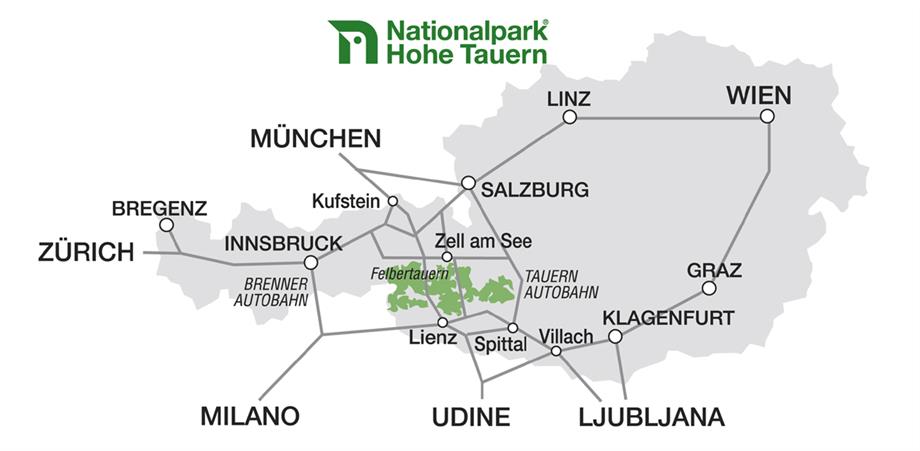
Hohe Tauern


Hohe Tauern National Park
• Bordering Carinthia, Salzburg and Tyrol
• With 185,600 hectares, the largest national park in the Alps
• Three establishment phases: 1981 (Carinthia), 1984 (Salzburg) and 1991 (Tyrol)
• Altitudes between 1,000 m in the valleys and 3,798 m above sea level at the peak of the Grossglockner
• More than one-third of all verified Austrian plant species
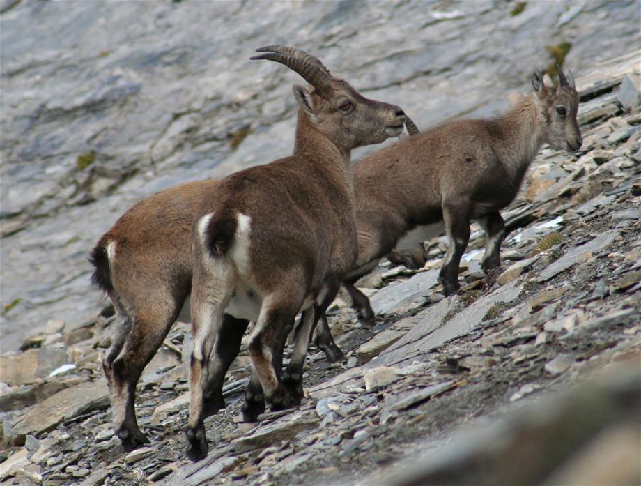
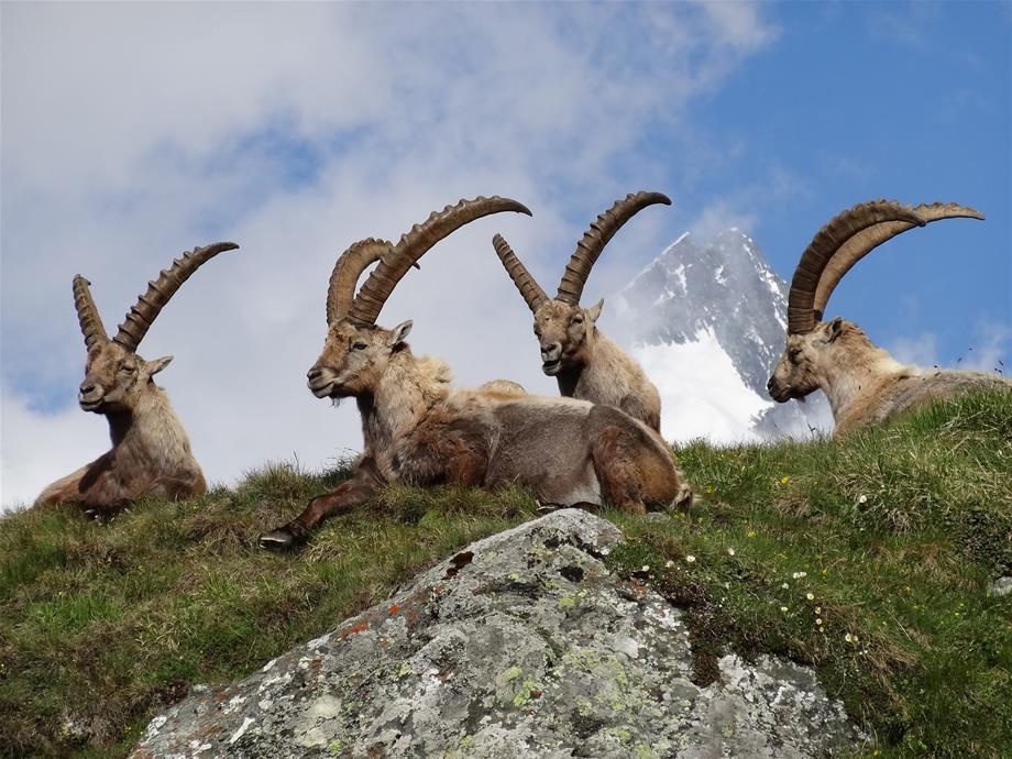
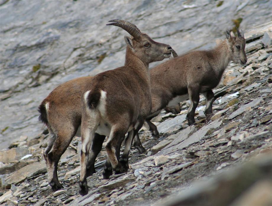
• Around half of all mammals, birds, reptiles and amphibians in Austria
• 1% open water areas, 32% agriculture and Alpine farming, 54% glaciers, scree corridors, rock walls and dwarf shrub heath, 4% alder and dwarf pine thickets, 9% forest
Established in 1981 and with an area of 185,600 hectares, the Hohe Tauern National Park is by far the largest nature conservation area in the Alps and Central Europe. The animal and plant world of the Hohe Tauern NP is representative of all high areas in the Alps and is characterised by its outstanding variety of species and habitats. More than one-third of all verified Austrian plant species occur in the Hohe Tauern National Park, and some 50% of all mammals, birds, reptiles and amphibians.
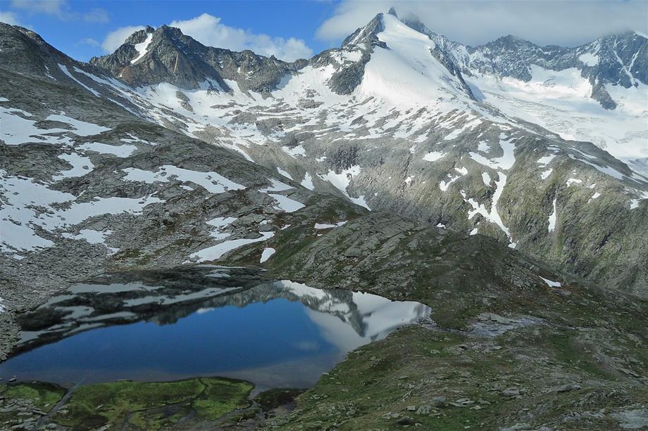
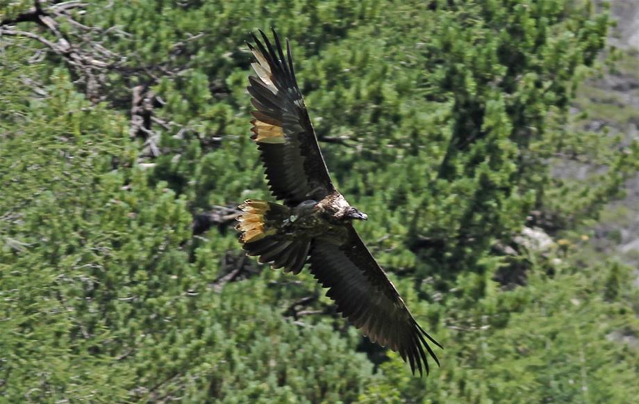
The conservation area extends across vast, ancient Alpine landscapes such as glaciers, rock walls, grasslands and cultural and pastoral landscapes. In addition to its role as a recreation area for humans and nature, the Hohe Tauern National Park is also key to Austrian research into the climate. Important initiatives concern the mass balance and melting of the glaciers, monitoring of the permafrost layer and the reintroduction of bearded vultures to the Alps.
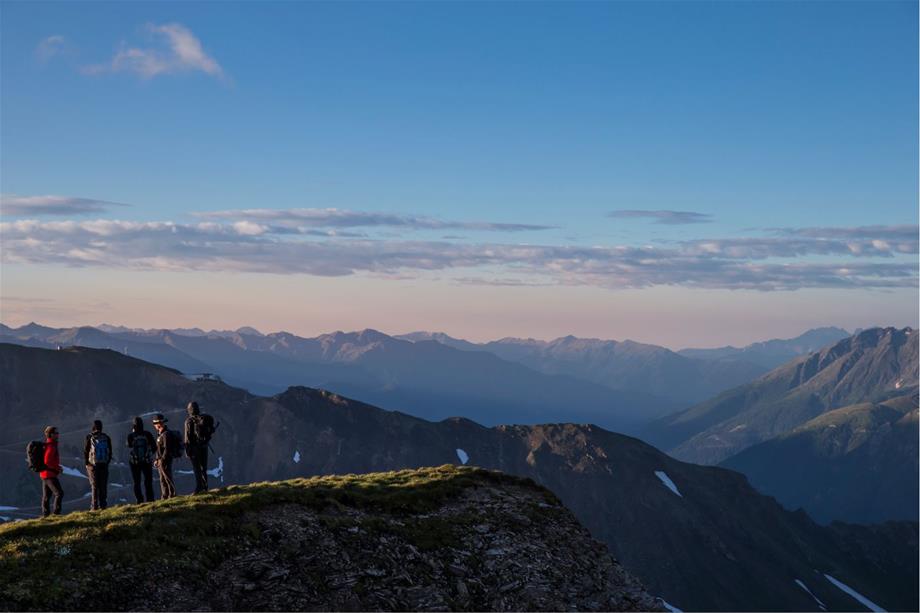
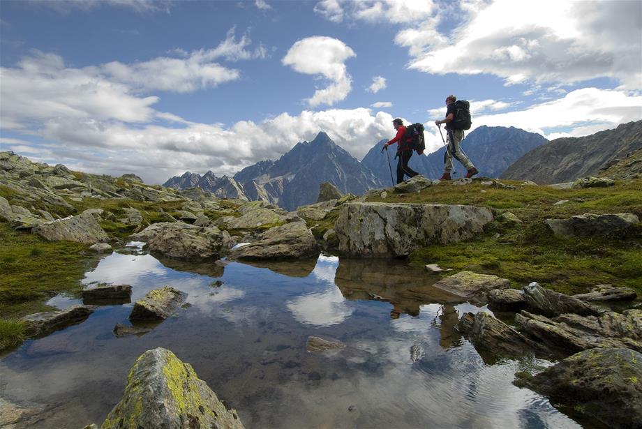
Geotrail/Heiligenblut hotspot
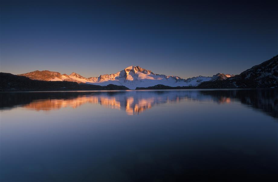
Diverse like nowhere else, the rocky world of Hohe Tauern stands out along the Tauernfenster geotrail. A marvellous alpine lake stretches out before the eyes of hikers. The visibility extends from the majestic Großglockner over more than 100 three-thousanders in the national park. In the area of the geotrail, the scenery is characterised by a variety of different rocks and, particularly welcome in the Hohe Tauern, atypical karst formations with their characteristic undulating terrain. Pronounced dolina, up to 14 metre deep shafts and small caves create captivating views.
Walking time: Approx. 3 hours (there and back)
Elevation: 200 m
Difficulty: easy
Path conditions: Very good
Opening times: July to October
Directions
Directions from Schareck: An arrow at the cable car station points the way to the Schareck (2,604 m), where a display provides an overview with the course of the geotrail. Steep descent to the Hochtor in parts. From there, it leads you over an impressive karst area to the left over the Roßköpfl (2,588 m). Following the descent of the Roßköpfl, you then follow the marked trail to the Hochtor through a travertine karst area.
Starting point
Heiligenblut, Scharek ascent with the gondola cableway (valley station in the town centre) or Großglockner High Alpine Road, Hochtor
Travel with public transport possible?
Yes. Information at www.postbus.at
Tour with ranger possible?
Yes. For information on guided hikes, please call: +43 (0) 4825 6161-0
Special animal and plant speciesParticularly interesting in a geological sense.
Rest points
Summit restaurant Schareck

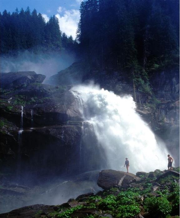
Krimml Waterfalls/Krimml hotspot
This impressive spectacle of nature offers abundant photo opportunities and gets the hearts of photography enthusiasts racing. 380 metres make the water masses tumble down and are thus the fifth-highest waterfalls in the world. The interplay of exposure and angle of light incidence is particularly exciting here.
Whether a professional or an amateur, everyone gets their money's worth at the Krimml Waterfalls. The most spectacular holiday memories can be eternalised here in digital or analogue form. A dedicated hiking trail is positioned close to this spectacle of water and light, which is framed by the breathtaking nature of the Hohe Tauern National Park. It is recommended to bring protection for your camera so that it is not damaged by water spray.
Walking time: approx. 1.5 hours
Elevation: 431 m
Kilometers: 4.15 km
Difficulty: easy
Path conditions: very good
Directions
It can be reached via the Zillertal and the Gerlos Pass or via Mittersill after Krimml.
Starting point
Parking area at the start of the waterfall trail
Travel with public transport possible?
Yes. For more details, please visit the Postbus and Pinzgau railway line website
www.postbus.at
www.pinzgauer-lokalbahn.info
Accessibility in winter
Not accessible, waterfall trail open between end of April and end of October
Tour with ranger possible?
Yes, please find information on guided waterfall hikes at: Tel. +43 (0) 6562 40489-0
Photographic featuresthundering water in every variation, impressive ravines, whoever climbs the waterfall trail can continue their hike in the Krimmler Achental - a high mountain valley with luscious mountain meadows and meandering rivers.
Special animal and plant species
Ostrich fern, rowan, lady's mantle, dwarf yellow cinquefoil, marsh grass-of-Parnassus and many more grow here. 327 different moss species - 1 andreaeaceae, 17 peat mosses, 88 liverworts and 221 bryophyta - flourish in the spray of the Krimml Waterfalls.
62 bird species, of which 9 are on the IUCN Red List, live in the surroundings of the waterfalls.
Best time to visitMagnificent interplays of light and water can be caught all day. (Morning until early afternoon in sunlight.)
The most water normally falls at the end of June and in July.
Rest points
Several at the foot of the falls and further on in the Krimmler Achenta
Other links
www.wasserfaelle-krimml.at

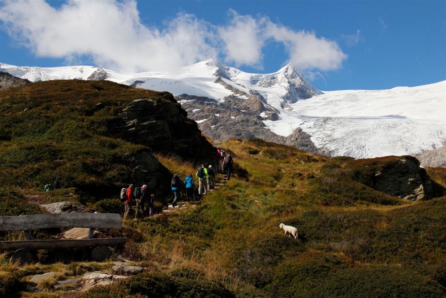
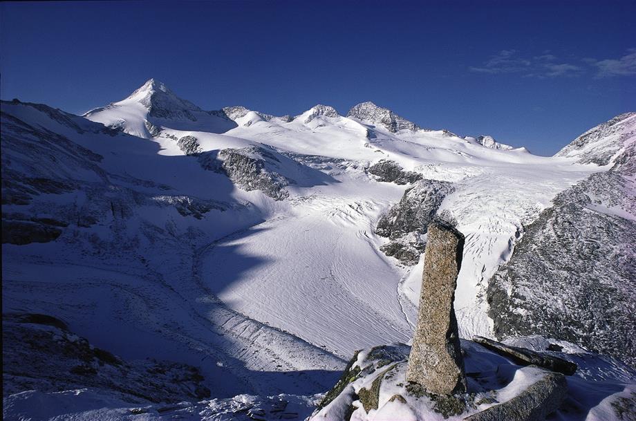
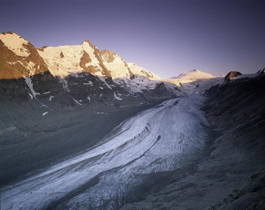
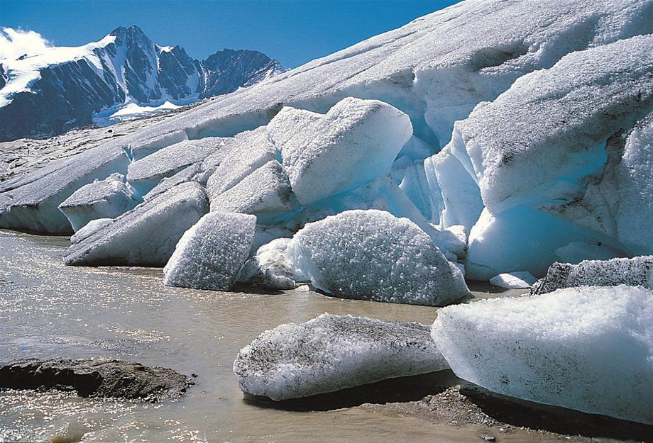
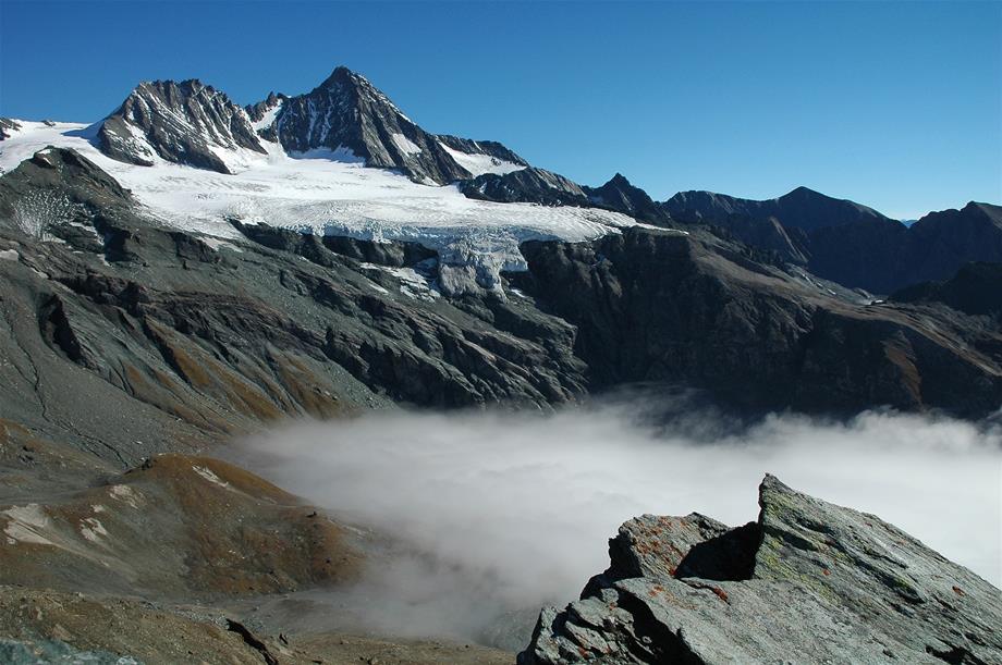
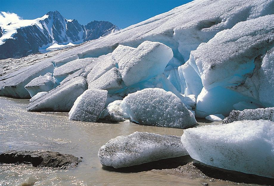
Glacier trail/Innergschlöß hotspot
At the heart of the Hohe Tauern National Park you hike through one of the most beautiful valleys in the Eastern Alps. The tremendous forces of the glaciers formed this landscape and they are still active here in the Hohe Tauern. Experience the breathtaking world of the glacier forefield and its pioneer vegetation.
The Salzbodensee, God's eye, which is usually adorned with a cotton grass island, the impressive glacial cutting and the Schlatenkees are just some of the highlights of the tour. The total 24 observation points of the glacial trails with the associated booklet (available in the "Venedigerhaus” inn in Innergschlöss) make the landscape dynamics of the glacier self-evident.
Walking time: Total of 7 hours (by taxi to Innergschlöß - 5 hours)
Elevation: 500 m
Trail length: Approx. 15 km
Difficulty: Challenging after Innergschlöß valley head.
Path conditions: Good - exposed stretches in parts
Opening times: Spring until autumn
Directions
The starting point is the Matreier Tauernhaus. From there you can easily walk to Innergschlöß in one and a half hours. The glacier trail starts at the end of the valley. It is very steep, good equipment and steady footing are therefore required. The circular alpine hike has a difference in elevation of approx. 500 m and it takes 4 hours.
Starting point
Matreier Tauernhaus (9971 Matrei in East Tyrol)
Travel with public transport possible?
Yes. The national park hiking bus goes to the Tauernhaus in the summer months. Information at www.postbus.at. Onward journey to Innergschlöß can be continued by taxi.
Tour with ranger possible?
Yes. For information on ranger tours, please call: +43 (0) 4875 5161-10
Special animal and plant species
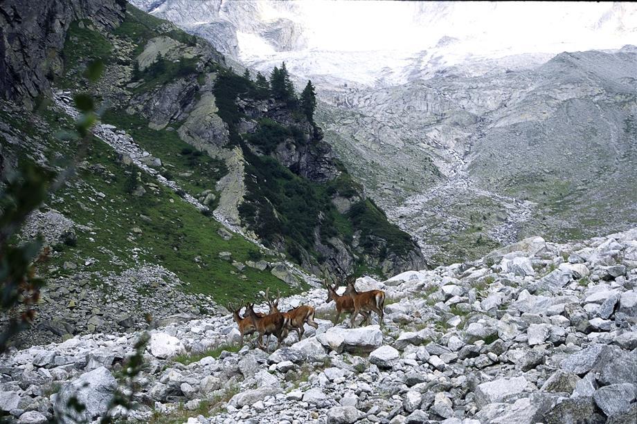
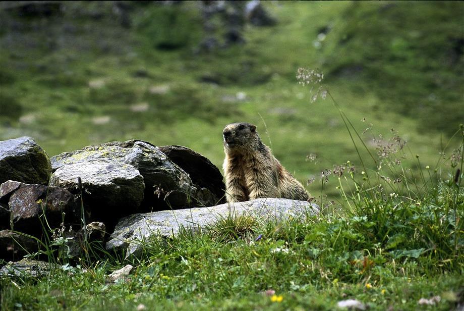
Glacier with snout, glacier forefield vegetation, mountain meadows, marmots, bearded vultures
Rest points
Mountain inn at Innergschlöß and mountain inn at Außergschlöß
Room bookings
Via our tourism partner: www.hohetauern.info
For bookings and information on national park ranger tours: Carinthia: +43 (0) 4825 6161-0
Tyrol: +43 (0) 4875 5161-0
Salzburg: +43 (0) 6562 40849-0

Travel Information
Link to a route planner here and also to the Austrian Federal Railways (train schedule query)
General travel information - opening times
In general, the Hohe Tauern National Park can be accessed free of charge. Dogs must not stray from designated trails and they must be kept on a lead. The national park can be explored from many side valleys of Pinzgau, Pongau and Lungau (Salzburg), Isel valley and Lienz valley (East Tyrol), Möll valley and in the area of Malta (Carinthia). There are usually visitor parking spaces with information boards at the starting points. What is more, visitors can gather detailed information from the national park communities in tourism offices or in the national park's own information points.
Contact
Hohe Tauern National Park
Carinthia, Salzburg, Tyrol
Council Secretariat
Tel. +43 (0) 4875 5112-0
nationalparkrat@hohetauern.at
http://www.hohetauern.at/en/
www.facebook.com/hohetauern
www.youtube.com/NationalparkHT
#hohetauern