Kalkalpen


Kalkalpen National Park
• In Upper Austria
• Established in 1997
• Covering 8 local authority areas and 9 so-called regional municipalities
• 20,825 ha in size
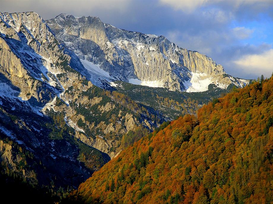
• Altitude between 385 m and 1,963 m above sea level at the Hoher Nock
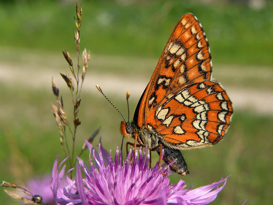
• 200 km protected stream beds, 800 sources, 30 forest communities, 50 species of mammals, 80 species of breeding birds, 1,000 different species of flowering plants, moss and ferns, and 1,400 species of butterfly
• 81% forest, 11% pastures and rock walls, 8% dwarf pines
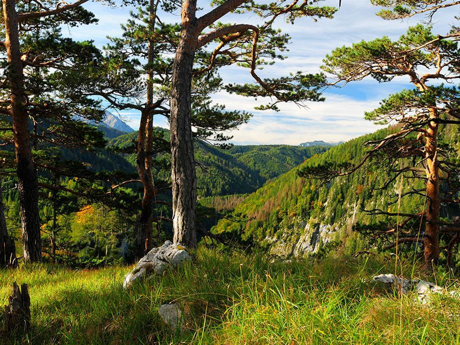
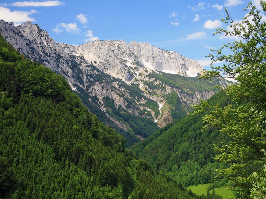
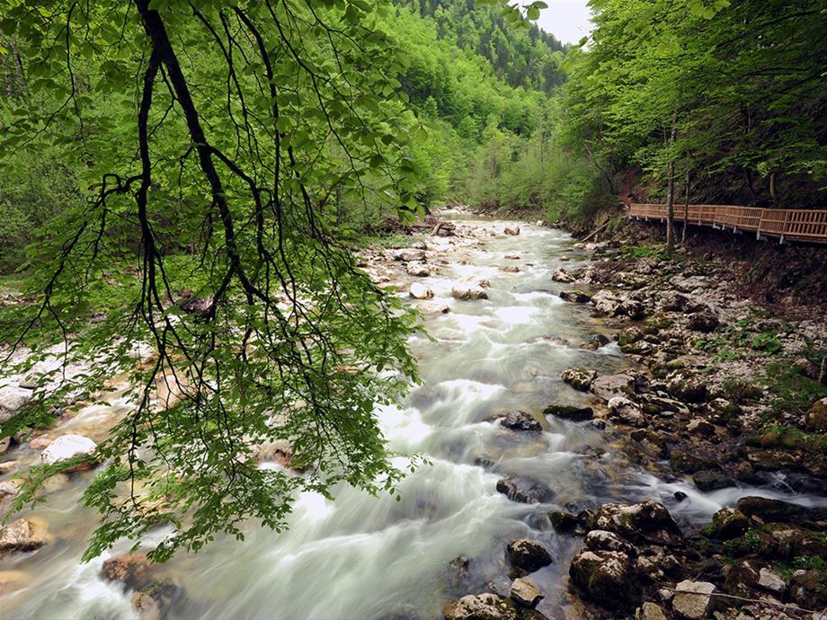
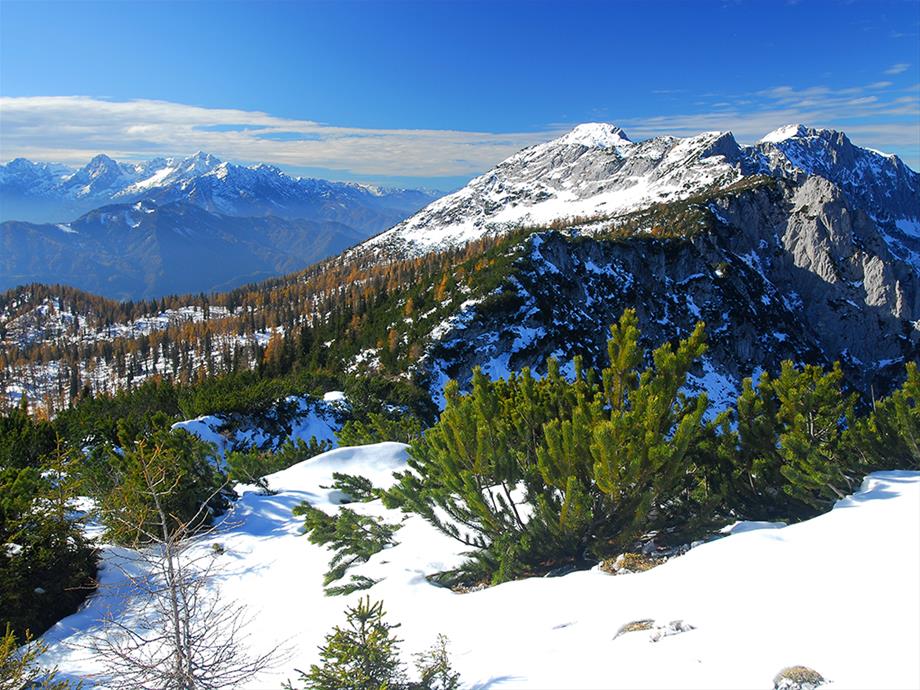
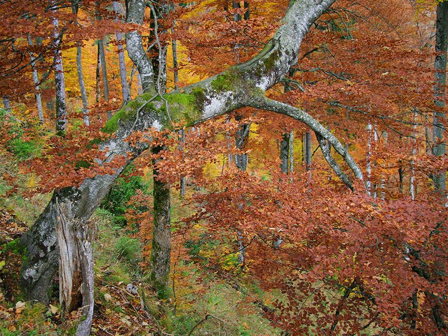
Established in 1997, the Kalkalpen National Park nestled between the Sensen Mountains and the Reichraminger Hintergebirge covers 20,825 hectares and is the largest forest reserve in Austria. Simultaneously a Ramsar Convention conservation and nature 2000 area, the national park offers a pot-pourri of extensive spruce, fir and beech forests, hidden gorges, pristine mountain streams and attractive high pastures.
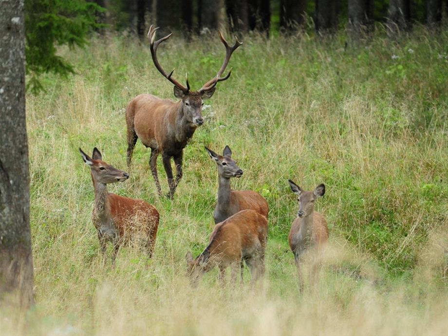
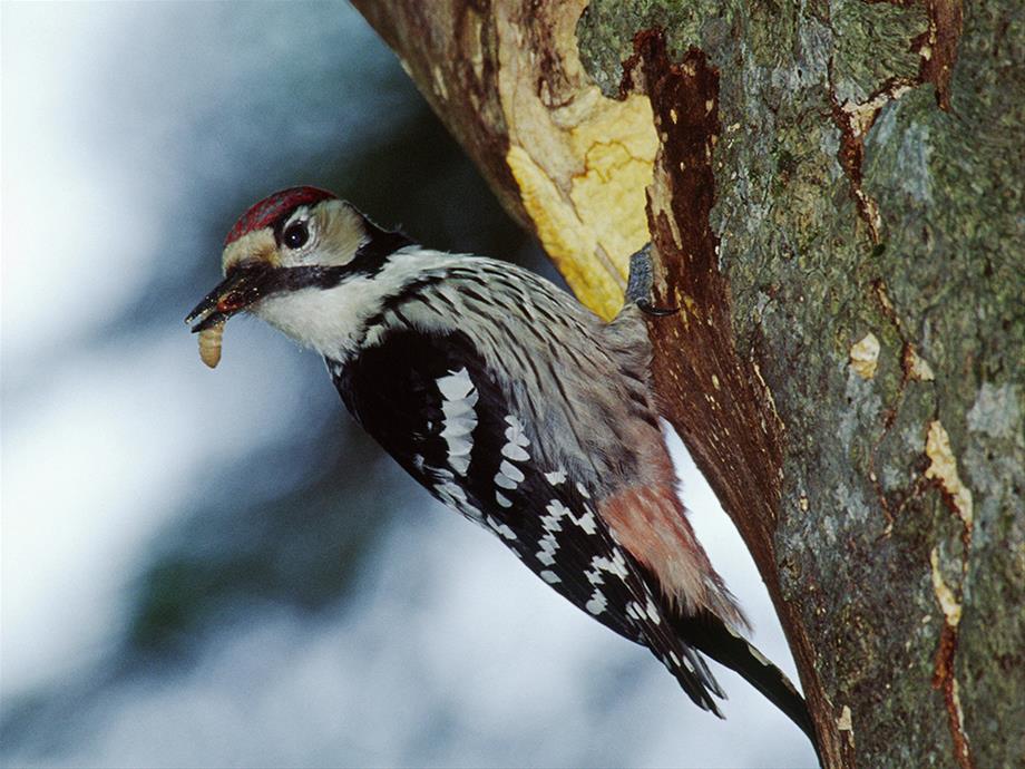
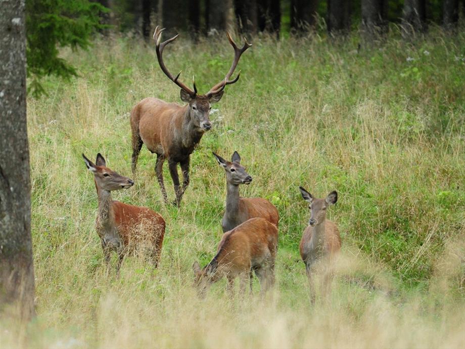
Rare and endangered animals and plants find habitat and refuge here, especially the lynx, the white-backed woodpecker and the Alpine Sawyer beetle, plus the clusius primrose and lady's slipper orchid. The canyons and karst springs of the Reichraminger Hintergebirge are also home to more than 500 species of animals, including spring snails and one of the few occurrences of the original Danube native river trout. The meadows and alpine pastures of the national park also provide habitat for grassland birds, butterflies and rare orchids. The national park is also devoted to the preservation of the high pastures and to ecological landscape management.
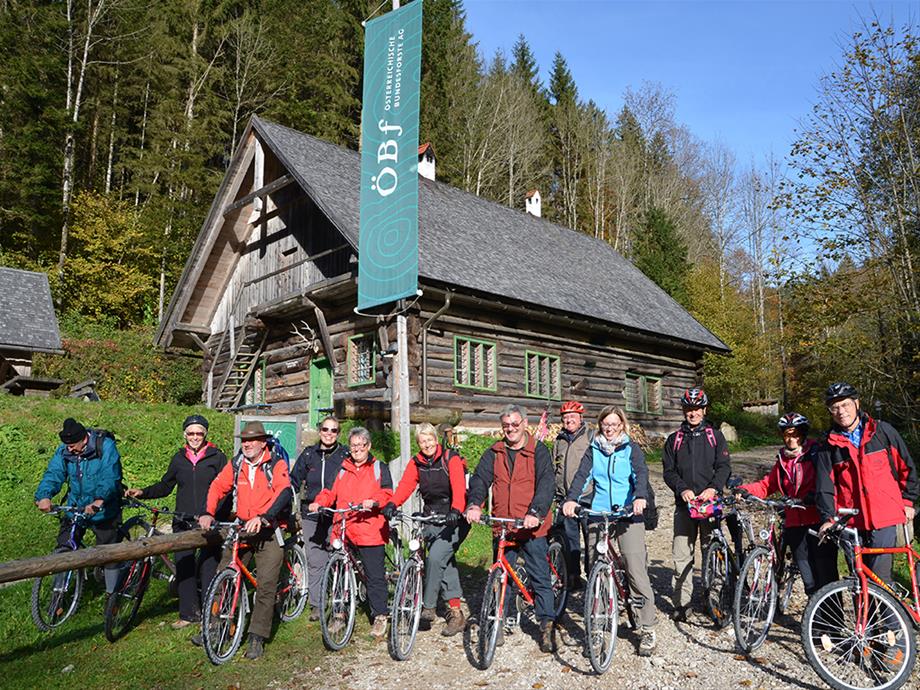
On the tracks of the forest railway
Hintergebirge cycle path, Ennstal national park Region
Starting point
Reichraming train station or parking spaces on the access road in the direction of Anzenbach-Schranken (parts are subject to charge)
Difference in elevation
580 meters
Difficulty
Family-friendly cycle path up to Weißwasser (slight ascent), further on via the Hirschkogel Sattel 200 metres of elevation have to be conquered over 5 km (steep ascent!)
Equipment
Waterproof clothing, food/drinks, swimwear where appropriate (cooling off in the Reichraming creek)
Rest Points
Supply stationGroße Klaushütte
Anlaufalm
Route description
Reichraming - along the Reichraming creek/large creek - straight into the Hintergebirge - after 15 kilometres Große Klause - after 4 kilometres entrance to Große Schlucht - Annerlsteg, here begins the drift climb - tunnels - Hochschlachtbach and Schleierfall - Schwarzen Bach - Weißwasser - 200 metres in elevation over 5 kilometres - Hirschkogel Sattel (where appropriate detour to Anlaufalm on foot or by mountain bike, approx. 30 minutes) - downhill to Brunnbach - along Plaißabach - Moaralm - Reichraming. Distance: 46 km. Travel time: approx. 3.5 to 4 hours
Observation tips
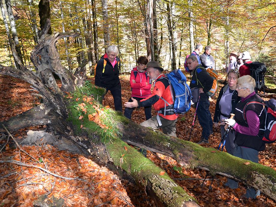
Without a doubt, the Hintergebirge cycling path is one of the most beautiful cycling routes in the whole of Austria. The majority of routes run over the former line of the forest railway. In 1971 it took its last journey through the Hintergebirge.
Große Klause, where you can comfortably descend part of the rope-guided climb in the former Klaushof.
The Große Klaus lodge (open between 1 May and 31 October from Monday to Sunday) provides welcome opportunities to rest.
Miscellaneous information
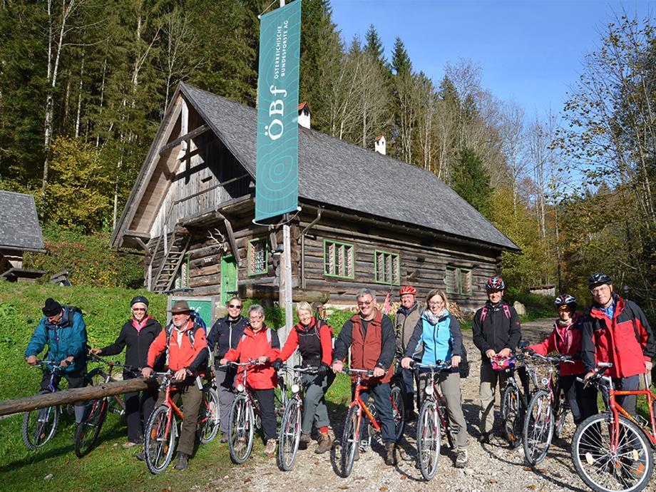
Bicycle tours in the Reichraming Hintergebirge are always perfectly complemented by train travel.
The themed cycle path Auf den Spuren der Waldbahn comprises around 46 adventurous kilometres, with an elevation difference of 522 m.
Bicycle rental in Reichraming:
• Bicycle rental Riedlecker
• e-bike rental station e-mobility
Map of "On the tracks of the forest railway” (430 KB)
Information and shop
Ennstal National Park visitor centre
Exhibition "Wunderwelt Waldwildnis” ["Wonder World of Forest Wilderness”]
Eisenstraße 75, 4462 Reichraming
Tel. 07254/8414-0
info-ennstal@kalkalpen.at
Reference to the new tour site:
https://wildniswandern.kalkalpen.at/de/touren/ (available as an app as of May 2017)
Rooms and bookings:
Ennstal and Steyrtal National Park region:
http://www.nationalparkregion.com
Pyhm Priel holiday destination:
http://www.urlaubsregion-pyhrn-priel.at/en.html

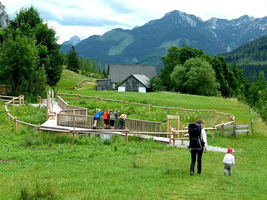
National Park Theme Path On the high pastures
Starting point
Puglalm, Karlhütte, Laussabaueralm on the Hengstpaß
Elevation
Between 780 and 880 meters
Difficulty level
Easy, parts also suited for prams/strollers (gravel road)
Equipment
Sturdy shoes, weather-proof clothing, rain protection, drinks
Refreshment Opportunities Puglalm
Laussabauernalm
Almstube Karlhütte
Egglalm
Route description
The theme path on Hengstpaß is a loop trail between the Puglalm, Karlhütte, and Laussabauernalm with a connection to the Egglalm.
At the foot of the Kampermauer at the Puglalm, the path leads through pastures, which give way to a section of forest. After crossing the Hengstpaßstraße, the Laussabauernalm is already within sight. From here, the path leads along the Rotkreuz stream to Rotkreuz chapel, where you can learn about the healing effects of the Rotkreuz spring. A short climb to the Hengstpaßstraße and you will have already completed the trail.
Time-on-trail is 2 hrs. at a leisurely pace, trail length ca. 4 km
Observation tips
Learn interesting information about life on the hill farm past and present.
Information & Shop
National Park Panorama Tower Wurbauerkogel
Dambach 152
4580 Windischgarsten
Tel + 43 (0) 75 62/20 046
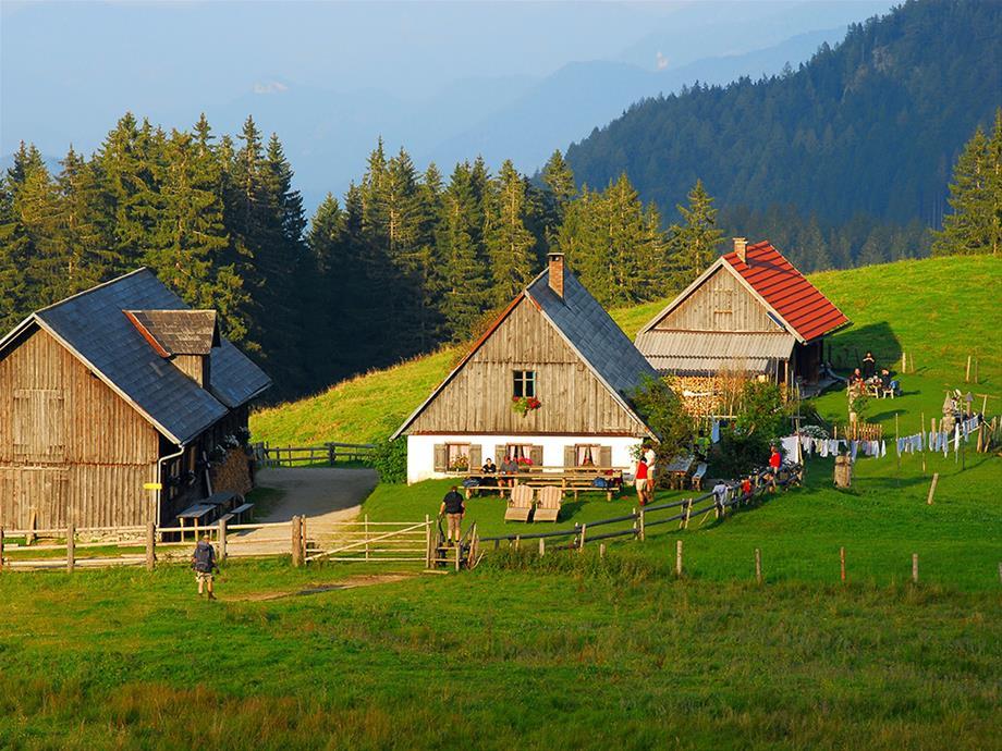

Hiking path to the Ebenforstalm,Trämpl, Alpstein, Schaumberg, Bodinggraben
Starting point
Molln/Bodinggraben - Scheiblingau car park
Elevation
Scheiblingau car park 588 m, Ebenforstalm 1,105 m, Trämpl 1,424 m - Alpstein 1,443 m - Schaumbergalm 1,150 m
Difficulty level
Intermediate
Equipment
Mountain boots, weather-proof clothing, drinks/snacks, Sengsengebirge hiking map, Reichraminger Hintergebirge hiking map, "Kompass” map No. 70
Refreshment opportunities
Jägerhaus in Bodinggraben
Ebenforstalm
Schaumbergalm
Route description
Scheiblingau car park - alongside the Krumme Steyrling - Jägerhaus - path No. 472 to the Ebenforstalm
Uphill hike Trämpl - Alpstein - short descent to the Schaumbergalm - Schaumbergalm path back to the valley - Jagahäusl -Scheiblingau car park, time-on-trail ca. 5.5 hrs.
Observation tips
The starting point, the Bodinggraben, is a rewarding destination all on its own. The Maulaufloch, the former hermitage, the splendid hunting lodge, and romantic St. Anne's chapel give this valley its special charm. On the way to the Ebenforstalm on path No. 472, we will see where the Bodinggraben got its name: erosion in the stone shaped by water- so-called "bathtubs" (German vernacular "Bodinge") dominate the canyon landscape.
Other
From May 1 to October 31, access to the Jagahäusl car park is allowed from 6 am - 9 am, after 9 am, please use the Scheiblingau car park.
Information & Shop
National Park Center Molln
A-4591 Molln, Nationalpark Allee 1
Tel + 43 (0) 75 84/36 51
Travel information
There are three main points of access to Kalkalpen National Park:
In the STEYRTAL via Molln/Bodinggraben to the Bodinggraben hiking area
In WINDISCHGARSTNER TAL to the Wurbauerkogel hiking area, via Roßleithen to the Veichltal hiking area, via Rosenau am Hengstpaß to the Hengstpaß hiking area, and via Unterlaussa to the Mooshöhe hiking area
In ENNSTAL via Reichraming to the Anzenbach hiking area and via Großraming to the Brunnbach hiking area
Travel eco-friendly to Kalkalpen National Park and use the train/bus combination and bike:
Arrival by train
Arrival by car
Every year from mid July to the beginning of October, the National Park Hiking Bus runs on Sundays from the bus station in Steyr to Reichraming, from here through the Hintergebirge to the Hengstpaß, and back. You can also take your bike along. Bike transport is free.
More information
Contact
Kalkalpen National Park
Nationalpark Allee 1
4591 Molln
T: + 43 (0) 7584 3651
F: + 43 (0) 7584 3654 Fax
nationalpark@kalkalpen.at
http://www.kalkalpen.at/system/web/sonderseite.aspx?menuonr=221633363&detailonr=221633363&sprache=2