See and Do
Donau-Auen NP
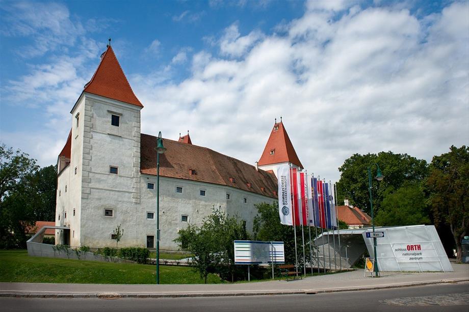

Guided by our National Park rangers, a tour of the Schlossinsel wetlands gardens surrounding schlossORTH is a great way to experience the Danube wetlands. Get an up-close look at the European pond turtle, Emys orbicularis, or glimpse a colubrid, a native snake which excels at the art of camouflage. Enter our walk-in underwater pond - without even getting wet! Observe various Danube fish species swimming in an underwater forest of Nuphar and Mare's-tail. Watch the pearl-like bubbles produced by aquatic plants as they "breathe" underwater. Experience the diversity of the Danube wetlands plant kingdom, from the climbing vine Traveller's Joy to tasty hops and the rustling leaves of the White Poplar.
After enjoying at the Schlossinsel, continue on into the wetlands forest on a guided walk along the Faden Creek, a former side arm of the Danube. Learn more about typical wetlands habitats such as side arms, riparian forest and flood protection barriers.
According to season, this tour offers special highlights such as spring bloomers, bird calls, dry grassland vegetation, amphibians, molluscs and - of course - lots of insects! Come visit these fascinating wetlands natives in their element.
Tour Overview:
Duration: approx. 2 hours
Persons: minimum of 15 persons
Price: € 11.50 per person

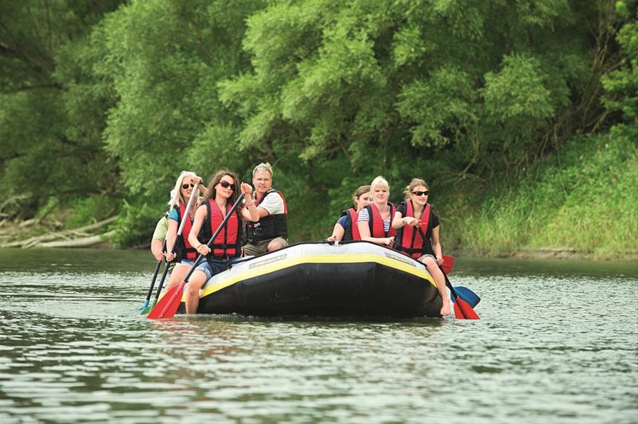
Rubber Dinghy Tour and Wetlands Walk in Orth/Danube
Together with National Park rangers, take a rubber dinghy from Orth/Danube onto a Danube side arm. First you will receive basic instruction in paddling, and then you will be ready to enter the wetlands forest. See where beavers have gone before you, and learn more about the tracks of nocturnal forest inhabitants. Water conditions permitting, a gravel bank - the nucleus of the wetlands - may emerge. You may even glimpse a heron, a kingfisher, or a beaver!
The tour continues with a walk on land with National Park rangers. No matter the season, this walk is always full of surprises. The flora and fauna of the Danube floodplains are especially rich: learn about deadwood (which is in fact very alive), or the reproductive and survival strategies of plants. High-water marks in the wetlands are true eye-openers, showing just how dynamic this riverine landscape is. Native amphibians and insects may cross your path, and you might even spot rare birds and mammals.
Tour Overview:
Meeting Point: Orth/Danube, Uferhaus restaurant parking lot
Duration: approx. 3 hours
Persons: minimum of 15 persons
Price: € 24 per person

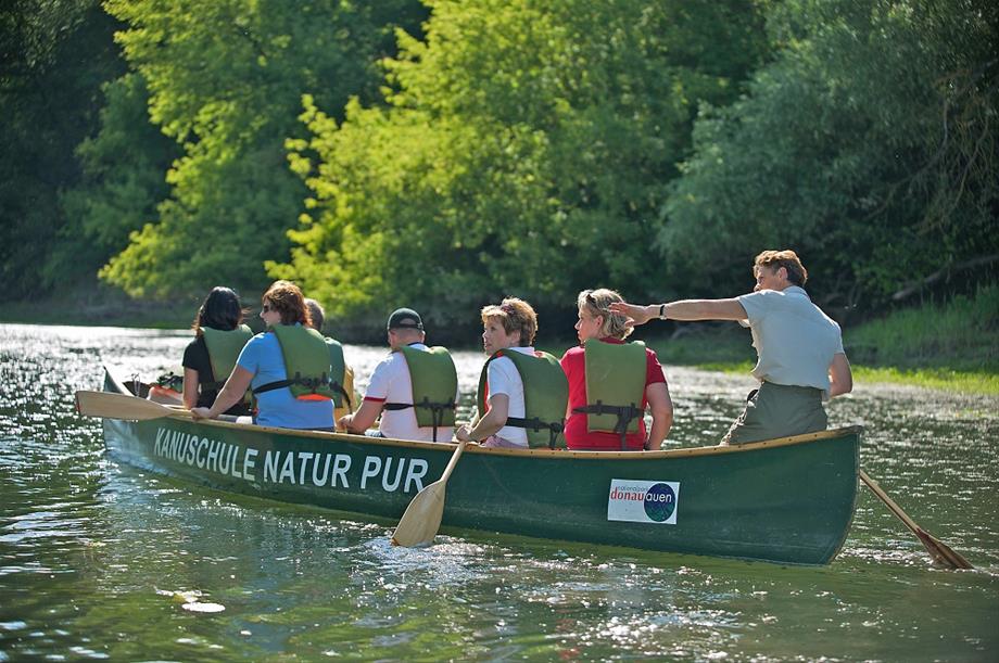
Canoe Tour in Stopfenreuth
Explore a former branch of the Danube in Stopfenreuth in a canoe with National Park rangers. After learning the basics of paddling, you will set out across calm waters, going as far as the mouth of the branch at the Danube.
Stopfenreuth is known as the birthplace of what came to be the National Park. It was here, in December 1984, where protesters were able to put a stop to plans for a Danube power plant at Hainburg by occupying the wetlands.
When water levels are as they should be, the waters are very clear. Fish can be seen swimming among the lush aquatic plants and floating lilies. Depending on the season, highlights of this tour may include sightings of European pond turtles, beavers, kingfishers, wild boars or deer.
Once the opposite Danube bank has been reached, the group disembarks and enjoys the marvellous view to the city of Hainburg. In the summer, take a dip in the river or look for shells, beaver tracks or pretty Danube pebbles. Then it's back in the canoes for the return trip on the same route back to Stopfenreuth.
Tour Overview:
Meeting Point: Stopfenreuth, Forsthaus restaurant at the Hochwasserschutzdamm (flood protection barrier)
Duration: approx. 3 hours
Persons: minimum of 9/max. 27 persons
Price: € 230 per canoe (minimum of 6, max. 9 persons)
Gesäuse NP

Haindlkar walk
• Starting point and end point: Bus stop Weidendom or Weidendom parking area
• Elevations: Weidendom 590 m, Haindlkar lodge 1,121 m, Gsengscharte 1,219 m
• Walking time: Weidendom - Leier trail - Haindlkar parking area: 0.5 hours; further to the Haindlkar lodge: 1.5 hours; further to the Gsengscharte (highest point): 20 minutes; Gsengscharte - Sagen trail/Wilder John - Weidendom: 1.5 hours, total walking time approx. 3.5-4 hours
• Difficulty/trail conditions: easy to moderately difficult trails and climbs in variable terrains, terrain briefly steep in some parts after Gsengscharte (secured with steel ropes and chains), sturdy footwear required
• Features: alpine landscape, rockfall blocks, alpine salamanders, chamois, delicate clove pink, lady's slipper, Wilder John theme trail
• Rest points: Haindlkar lodge, zur Bachbrücke inn (at Weidendom)
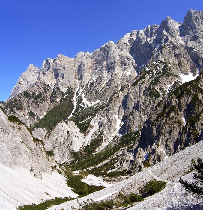
This wonderful and short tour starts at the bus stop Weidendom or at Weidendom parking area and first leads via the Leierweg along the connection path through a mixed beech forest to the Haindlkar parking area (cross 1 main road). This where the ascent to Haindlkar, trail no. 658 begins, accompanied by the fine bushes of amelanchier and purple heather. Chalk-loving rowanberries, mountain pines and scattered juniper bushes are dotted around the alpine environment, up past the quaint old Haindlkar lodge (1,080 m) to the new Haindlkar lodge (1,121 m).
With a bit of luck, you may come across a black alpine salamander along the trail. The new Haindlkar lodge is a great place to eat and you can watch climbers conquering the Hochtor north face from the terrace (binoculars can be borrowed from the lodge). After a short refreshment, the adventure continues on trail no. 658. This first leads you through a debris flow and then through a pine field to the highest point of the trek at the Gsengscharte (1,219 m). Impressive views of the jagged rocks of the Hochtor range can be enjoyed. Even the distant Admont basin can be seen from here.
On the descent (steady footing required), the first few meters lead you over rocks that are secured with steel ropes and chains, and then down through the sunny and striking gravel field Gseng. If you take a seat further below in the secure mountain pine area, you can sense the processes that are eroding the mountain. During an attentive hike, you will catch sight of chamois every now and again or find delicate clove pink (strictly protected endemic plant) at the edge of the trail. From Fseng, you will then arrive at the Sagen trail (no. 71, 608) and turn right, heading north to the end of the themed trail Wilder John. Then you will pass through the forest and arrive at a lodge for visitor area Hellichter Stein, where you can rinse your feet in the cooling waters of Johnsbach. In spring, the largest native variety of orchid, the lady's slipper, grows along the Wilder John, which tells the story of Johnbach at various locations. A few meters after the crossing of the debris flow Humlechner Graben, you arrive at the discovery centre Weidendom (parking area, bus stop, inn).

Hartelsgraben, Sulzkaralm and Hess Lodge
• Starting point: Parking area at Hartelgraben (directly by Gesäuse main road)
• End point of the hike: Pub/parking area by Kölblwirt in Johnsbach
• Elevations: Parking area at Hartelsgraben 521 m, Sulzkaralm 1,453 m, Sulzkarhund 1,821 m, Hess lodge 1,699 m, Johnsbach 860 m, Zinödl 2,191 m
• Walking time: Hartelsgraben - Sulzkaralm - Hess lodge: approx. 5 hours Hess lodge - Johnsbach: approx. 2 hours Optionally, Hess lodge - Zinödl (ascent only!): 1.5 hours via the normal trail or 2 hours via the panorama trail
• Difficulty/trail conditions: moderately difficult trails and climbs in varying terrain, steep in parts but never exposed, sturdy footwear required
• Features: Themed trail Hartelsgraben, high mountain panoramas, natural forests, biodiverse alpine landscape, marmots, larch forest
• Rest points: Hess lodge, Kölblwirt (Johnsbach)
My favourite hiking route leads through the Hartelsgraben to the Sulzkaralm, and then to the Hess lodge, ending in Johsbachtal. I find this route particularly pleasant because it combines the experience of a wild forest landscape, blooming alpine pastures, alpine mountain scenery and the cosiness of a stop at an alpine hut. The first part of the route passes through the Hartelsgraben to trail no. 665 via the oldest forest road in Styria. The cool, humid air in the ravine forest is a welcome refreshment on warm summer days. The ravine forest that you pass through is a special feature, as it is one of the forest types in the area less dominated by hardwood. The history of the old forest road and past intensive charcoal smelting is illustrated along the themed trail in the Hartelsgraben.
After the long ascent along the old forest road, you reach the first pastures of the Sulzkaralm via trail 601. It captivates with its stunning alpine landscape. Tall spruces, ricks in the middle of the pastures, small bogs with cotton grass and a small lake - the Sulzarsee - are not only the habitat of a variety of plants and animals, they also inspire those who pass through them. It is easy to observe marmots or chamois on the steep flanks surrounding the mountain pasture. Cows and horses graze on the alpine pastures, the small alpine huts invite you to take a short break and refresh yourself at the spring.
From the Sulzkaralm, you follow a steep incline to the so-called Sulzkarhund, a characteristic rock formation that resembles a dog. From the saddle, you then head downhill slightly to trail no. 601 towards Hess lodge where you can finally treat yourself to a well-deserved break. In addition to a hearty meal and a cool drink, you can take in the view of the Hochtor range and the Zinödl on the sun terrace. Sporty types have the option of climbing to the summit of the Zinödl on trail no. 662 before stopping off at the lodge. True to its name, the "panorama trail” on the Zinödl (trail no. 62) provides an impressive view of the surrounding Gesäuse summit and the landscape of the Enns valley.
It is worth going down to the valley before nightfall. Trail no. 601 to Johnsbach is the shortest and safest trail. In addition, shortly after the Hess lodge, you wander through a larch forest which boasts a yellow glow in autumn. Once you have arrived at Johnsbachtal, it is best to take a Gseispur taxi in order return to the starting point quickly and easily or to your accommodation in the area.

Rauchboden Trail
• Starting point: Gstatterboden or parking area at Buchsteinhaus
• End point of the hike: Weidendom discovery centre
• Elevations: Parking area at Buchsteinhaus 573 m, Rauchboden 657 m (highest point), Buchsteinhaus 1,546 m, Weidendom discovery centre 590 m
• Walking time: Gstatterboden - Weidendom: approx. 1.5 hours (3.5 km). Optionally, Gstatterboden - Buchsteinhaus (ascent only!): approx. 3 hours (day trip with children)
• Difficulty/path conditions: Easy hike/forest road; alternative route to the Enns cycle path R7; Buchsteinhaus: moderately difficult climb on varying terrain, sturdy footwear required
• Features: Magnificent views of the Hochtor and Reichenstein range, spectacular views down to the roaring Enns, natural forests, mountain bike trail, Buchsteinhaus (with sun terrace)
• Rest points: Pavillon Gstatterboden National Park, Zur Bachbrücke inn/Weidendom, Buchsteinhaus
What do National Park Förster Martin Zorn and travel agency manager Isabella Mitterböck have in common? She is often drawn here with her family to hike the Rauchboden trail and sometimes, when they have a full day to spare, and taste a new delicious meal at the Buchsteinhaus. What is special about this route is the first-hand experience of all 3 distinct habitats of the national park, which are reflected in the national park logo: water, forest and rock. The starting point of the hike is the parking area at the Buchsteinhaus in Gstatterboden. After crossing the bridge over the Enns, make a left turn onto the Rauchboden trail that begins with a brief steep section. A magnificent view of the mighty Hochtor range and its highest elevation, the Hochtor standing at 2,369 m and a breathtaking view down to the booming, unspoilt Enns await you as a reward. The shaded forest that you wander through provides an ideal breeding ground and very special habitat for a variety of beings with its infested deadwood trees, which are deliberately left in a national park.
The varying ascent to the Buchsteinhaus begins in the area of an old cabbage patch (trail no. 641), passing through unspoiled forest where population transformations have already taken place. You will soon reach a debris flow (Kuhgraben), which you will cross and continue towards the Brucksattel. The last part leads to the Buchsteinhaus, which is situated at the junction between the forest and pine area at a height of 1,546 m, via a not too difficult and shaded zig-zag trail. The view of the mountains from the redesigned sun terrace and the delicious food will help you forget about your tired legs. You should not leave too late (especially with children) for this day trip and you should bring waterproof clothing, sturdy footwear and, most importantly, enough to drink - there is no water available on the trail.
Should you remain on the Rauchboden trail, then you will shortly cross a bridge that leads over the Kühgraben. Here you can marvel at the successful reforestation project of the torrent control. On the opposite side there is a magnificent view of the Haindlkar with the legendary Peternpfad, named after the poacher "Schwarzer Peter” who once committed his terrible deeds in these steep gorges. The trail gently continues at a slight ascent and with a bit of luck (if you are not too loud) you might encounter a herd of chamois refreshing themselves in the morning or evening at the spring that flows across the road. The forest road then begins to descend and the last part, before arriving at the train stop Johnsbach, is characterised by ancient forests dominated by spruce. In this area, natural regeneration and population transformation, implemented by the Styrian state forests, are underway.
At the Johnsbach stop, there are magnificent views of Johnsbachtal and of the surrounding mountains of Gesäuse, which is especially exciting for children! Then you carefully cross the railway line and the new, wheelchair-accessible Johnsbach bridge with a wonderful viewing window overlooking the wild, booming Enns. A visit to the Weidendom discovery centre or the legendary trail "Der Wilde John”, which winds along the adventure stations to Johnsbachtal, marks the end of this eventful trip.
There are various options for returning to your car in Gstatterboden: You can either walk back along the Rauchboden trail or take a taxi from Gseispur or a public bus.
You can also now ride a mountain bike along the Rauchboden trail, to the delight of Isabella and Martin, since they not only ardent hikers, but also passionate bikers!
Hohe Tauern NP
Geotrail/Heiligenblut hotspot
Diverse like nowhere else, the rocky world of Hohe Tauern stands out along the Tauernfenster geotrail. A marvellous alpine lake stretches out before the eyes of hikers. The visibility extends from the majestic Großglockner over more than 100 three-thousanders in the national park. In the area of the geotrail, the scenery is characterised by a variety of different rocks and, particularly welcome in the Hohe Tauern, atypical karst formations with their characteristic undulating terrain. Pronounced dolina, up to 14 metre deep shafts and small caves create captivating views.
Walking time: Approx. 3 hours (there and back)
Elevation: 200 m
Difficulty: easy
Path conditions: Very good
Opening times: July to October
Directions
Directions from Schareck: An arrow at the cable car station points the way to the Schareck (2,604 m), where a display provides an overview with the course of the geotrail. Steep descent to the Hochtor in parts. From there, it leads you over an impressive karst area to the left over the Roßköpfl (2,588 m). Following the descent of the Roßköpfl, you then follow the marked trail to the Hochtor through a travertine karst area.
Starting point
Heiligenblut, Scharek ascent with the gondola cableway (valley station in the town centre) or Großglockner High Alpine Road, Hochtor
Travel with public transport possible?
Yes. Information at www.postbus.at
Tour with ranger possible?
Yes. For information on guided hikes, please call: 04825 6161-0
Special animal and plant speciesParticularly interesting in a geological sense.
Rest points
Summit restaurant Schareck
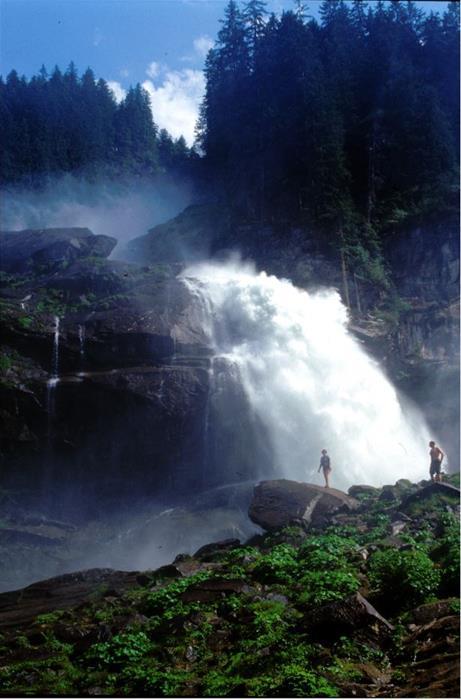

Krimml Waterfalls/Krimml hotspot
This impressive spectacle of nature offers abundant photo opportunities and gets the hearts of photography enthusiasts racing. 380 metres make the water masses tumble down and are thus the fifth-highest waterfalls in the world. The interplay of exposure and angle of light incidence is particularly exciting here.
Whether a professional or an amateur, everyone gets their money's worth at the Krimml Waterfalls. The most spectacular holiday memories can be eternalised here in digital or analogue form. A dedicated hiking trail is positioned close to this spectacle of water and light, which is framed by the breathtaking nature of the Hohe Tauern National Park. It is recommended to bring protection for your camera so that it is not damaged by water spray.
Walking time: approx. 1.5 hours
Elevation: 431 m
Kilometers: 4.15 km
Difficulty: easy
Path conditions: very good
Directions
It can be reached via the Zillertal and the Gerlos Pass or via Mittersill after Krimml.
Starting point
Parking area at the start of the waterfall trail
Travel with public transport possible?
Yes. For more details, please visit the Postbus and Pinzgau railway line website
www.postbus.at
www.pinzgauer-lokalbahn.info
Accessibility in winter
Not accessible, waterfall trail open between end of April and end of October
Tour with ranger possible?
Yes, please find information on guided waterfall hikes at: Tel. 06562 40489-0
Photographic featuresthundering water in every variation, impressive ravines, whoever climbs the waterfall trail can continue their hike in the Krimmler Achental - a high mountain valley with luscious mountain meadows and meandering rivers.
Special animal and plant species
Ostrich fern, rowan, lady's mantle, dwarf yellow cinquefoil, marsh grass-of-Parnassus and many more grow here. 327 different moss species - 1 andreaeaceae, 17 peat mosses, 88 liverworts and 221 bryophyta - flourish in the spray of the Krimml Waterfalls.
62 bird species, of which 9 are on the IUCN Red List, live in the surroundings of the waterfalls.
Best time to visitMagnificent interplays of light and water can be caught all day. (Morning until early afternoon in sunlight.)
The most water normally falls at the end of June and in July.
Rest points
Several at the foot of the falls and further on in the Krimmler Achenta
Other links
www.wasserfaelle-krimml.at

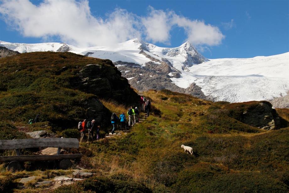
Gletscherlehr trail/Innergschlöß hotspot
At the heart of the Hohe Tauern National Park you hike through one of the most beautiful valleys in the Eastern Alps. The tremendous forces of the glaciers formed this landscape and they are still active here in the Hohe Tauern. Experience the breathtaking world of the glacier forefield and its pioneer vegetation.
The Salzbodensee, God's eye, which is usually adorned with a cotton grass island, the impressive glacial cutting and the Schlatenkees are just some of the highlights of the tour. The total 24 observation points of the glacial trails with the associated booklet (available in the "Venedigerhaus” inn in Innergschlöss) make the landscape dynamics of the glacier self-evident.
Walking time: Total of 7 hours (by taxi to Innergschlöß - 5 hours)
Elevation: 500 m
Trail length: Approx. 15 km
Difficulty: Challenging after Innergschlöß valley head.
Path conditions: Good - exposed stretches in parts
Opening times: Spring until autumn
Directions
The starting point is the Matreier Tauernhaus. From there you can easily walk to Innergschlöß in one and a half hours. The glacier trail starts at the end of the valley. It is very steep, good equipment and steady footing are therefore required. The circular alpine hike has a difference in elevation of approx. 500 m and it takes 4 hours.
Starting point
Matreier Tauernhaus (9971 Matrei in East Tyrol)
Travel with public transport possible?
Yes. The national park hiking bus goes to the Tauernhaus in the summer months. Information at www.postbus.at. Onward journey to Innergschlöß can be continued by taxi.
Tour with ranger possible?
Yes. For information on ranger tours, please call: 04875 5161-10
Special animal and plant species
Glacier with snout, glacier forefield vegetation, mountain meadows, marmots, bearded vultures
Rest points
Mountain inn at Innergschlöß and mountain inn at Außergschlöß
Kalkalpen National Park

On the tracks of the forest railway
Hintergebirge cycle path, Ennstal national park Region
Starting point
Reichraming train station or parking spaces on the access road in the direction of Anzenbach-Schranken (parts are subject to charge)
Difference in elevation
580 meters
Difficulty
Family-friendly cycle path up to Weißwasser (slight ascent), further on via the Hirschkogel Sattel 200 metres of elevation have to be conquered over 5 km (steep ascent!)
Equipment
Waterproof clothing, food/drinks, swimwear where appropriate (cooling off in the Reichraming creek)
Rest Points
Supply stationGroße Klaushütte
Anlaufalm
Route description
Reichraming - along the Reichraming creek/large creek - straight into the Hintergebirge - after 15 kilometres Große Klause - after 4 kilometres entrance to Große Schlucht - Annerlsteg, here begins the drift climb - tunnels - Hochschlachtbach and Schleierfall - Schwarzen Bach - Weißwasser - 200 metres in elevation over 5 kilometres - Hirschkogel Sattel (where appropriate detour to Anlaufalm on foot or by mountain bike, approx. 30 minutes) - downhill to Brunnbach - along Plaißabach - Moaralm - Reichraming. Distance: 46 km. Travel time: approx. 3.5 to 4 hours
Observation tips
Without a doubt, the Hintergebirge cycling path is one of the most beautiful cycling routes in the whole of Austria. The majority of routes run over the former line of the forest railway. In 1971 it took its last journey through the Hintergebirge.
Große Klause, where you can comfortably descend part of the rope-guided climb in the former Klaushof.
The Große Klaus lodge (open between 1 May and 31 October from Monday to Sunday) provides welcome opportunities to rest.
Miscellaneous information
Bicycle tours in the Reichraming Hintergebirge are always perfectly complemented by train travel.
The themed cycle path Auf den Spuren der Waldbahn comprises around 46 adventurous kilometres, with an elevation difference of 522 m.
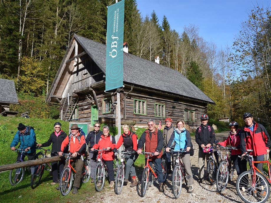
Bicycle rental in Reichraming:
• Bicycle rental Riedlecker
• e-bike rental station e-mobility
Map of "On the tracks of the forest railway” (430 KB)
Information and shop
Ennstal National Park visitor centre
Exhibition "Wunderwelt Waldwildnis” ["Wonder World of Forest Wilderness”]
Eisenstraße 75, 4462 Reichraming
Tel. 07254/8414-0
info-ennstal@kalkalpen.at
Reference to the new tour site:
https://wildniswandern.kalkalpen.at/de/touren/ (available as an app as of May 2017)
Rooms and bookings:
Ennstal and Steyrtal National Park region:
http://www.nationalparkregion.com
Pyhm Priel holiday destination:
http://www.urlaubsregion-pyhrn-priel.at/en.html

National Park Theme Path On the high pastures
Starting point
Puglalm, Karlhütte, Laussabaueralm on the Hengstpaß
Elevation
Between 780 and 880 meters
Difficulty level
Easy, parts also suited for prams/strollers (gravel road)
Equipment
Sturdy shoes, weather-proof clothing, rain protection, drinks
Refreshment Opportunities Puglalm
Laussabauernalm
Almstube Karlhütte
Egglalm
Route description
The theme path on Hengstpaß is a loop trail between the Puglalm, Karlhütte, and Laussabauernalm with a connection to the Egglalm.
At the foot of the Kampermauer at the Puglalm, the path leads through pastures, which give way to a section of forest. After crossing the Hengstpaßstraße, the Laussabauernalm is already within sight. From here, the path leads along the Rotkreuz stream to Rotkreuz chapel, where you can learn about the healing effects of the Rotkreuz spring. A short climb to the Hengstpaßstraße and you will have already completed the trail.
Time-on-trail is 2 hrs. at a leisurely pace, trail length ca. 4 km
Observation tips
Learn interesting information about life on the hill farm past and present.
Information & Shop
National Park Panorama Tower Wurbauerkogel
Dambach 152
4580 Windischgarsten
Tel + 43 (0) 75 62/20 046

Hiking path to the Ebenforstalm,Trämpl, Alpstein, Schaumberg, Bodinggraben
Starting point
Molln/Bodinggraben - Scheiblingau car park
Elevation
Scheiblingau car park 588 m, Ebenforstalm 1,105 m, Trämpl 1,424 m - Alpstein 1,443 m - Schaumbergalm 1,150 m
Difficulty level
Intermediate
Equipment
Mountain boots, weather-proof clothing, drinks/snacks, Sengsengebirge hiking map, Reichraminger Hintergebirge hiking map, "Kompass” map No. 70
Refreshment opportunities
Jägerhaus in Bodinggraben
Ebenforstalm
Schaumbergalm
Route description
Scheiblingau car park - alongside the Krumme Steyrling - Jägerhaus - path No. 472 to the Ebenforstalm
Uphill hike Trämpl - Alpstein - short descent to the Schaumbergalm - Schaumbergalm path back to the valley - Jagahäusl -Scheiblingau car park, time-on-trail ca. 5.5 hrs.
Observation tips
The starting point, the Bodinggraben, is a rewarding destination all on its own. The Maulaufloch, the former hermitage, the splendid hunting lodge, and romantic St. Anne's chapel give this valley its special charm. On the way to the Ebenforstalm on path No. 472, we will see where the Bodinggraben got its name: erosion in the stone shaped by water- so-called "bathtubs" (German vernacular "Bodinge") dominate the canyon landscape.
Other
From May 1 to October 31, access to the Jagahäusl car park is allowed from 6 am - 9 am, after 9 am, please use the Scheiblingau car park.
Information & Shop
National Park Center Molln
A-4591 Molln, Nationalpark Allee 1
Tel + 43 (0) 75 84/36 51
Neusiedlersee - Seewinkel NP

Einmal Hölle und zurück ["To hell and back”]
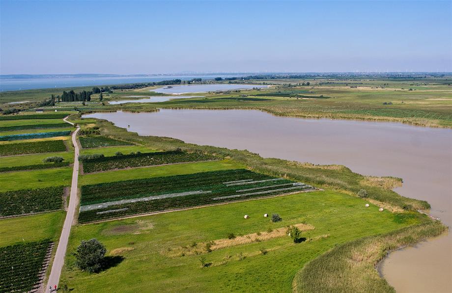
Where "hell” got its name from, is not easy to discern. The nature along the roughly 20 km sand dam at the eastern bank of Lake Neusiedl is in no way hellish, but rather a paradise for many rare and protected species.
From the national park information in Illmitz you hike through the village to Seestraße. At the Zicklacke, you fork to the right at Kirchentellinsfurter Platz. The muddy ground of the shallow body of water contains Glauber's salt and sodium carbonate ("Zick”, Hungarian for sodium carbonate). Like all coatings of the lowlands, it is fed by the rain. It slowly dries out in the summer heat, and the salt crystallises at the surface. Coastal plants such as the salt cress, salt wormwood or salt fescue then grow here.
The trail to the north leads directly to the Unteren und Oberen Stinkersee. In these two lakes, as in the adjacent meadows, breeding birds and - depending on the season - many migratory bird species can be observed from the trail, but predominantly from the observation towers with binoculars and spotting scope.
The wine tavern "Zur Hölle” to the north of the Oberen Stinkersee is recommended as a rest area, and is not far from the large observation tower. Heading back south, after the stables of Prewalski wild horses you follow the natural lake dam towards the biological stop. One of the observation spots most treasured by ornithologists is at the Illmitz lake grove, not far from Seestraße. After the crossing, the trail leads to Sandeck, where the rare white donkey has been introduced for grazing in the national park between the sand an reeds. From there you get back to Illmitz and the information centre to the south of the Kirchsee.
Trail length: approx. 23 km
Duration with time for observation: 7-8 hours
Don't forget your binoculars!
Note: The restricted trails apply throughout the Neusiedler See - Seewinkel / Fertö - Hanság National Park. Entering meadow, water and reed areas is strictly forbidden in all zones.
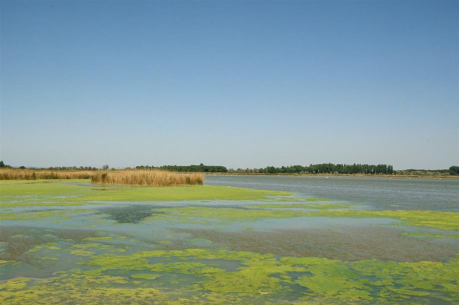

Around the Lange Lacke
The most extensive salt lake of the national park is to the north of the village of Apetlon. For the biodiversity in the nature of Lake Neusiedl it is just as important as the surrounding pastures - a treeless, steppe-like cultivated landscape and some smaller reed areas.
Coming from the village of Apetlon, you hike roughly two kilometres north to the so-called Darscho (Warmsee). This lake is not located in the national park, and the healing effect of the mud can still be verified today. The vegetation-free lake edge should be observed more closely, since it is the preferred habitat for waders such as plover, redshank or ruff passing through.
Further north, just behind the Rosaliakapelle, you will reach the Große Neubruchlacke. Its water level fluctuates with sediment and evaporation, like all Seewinkel lakes. After an excursion to the nearby Fuchslochlacke, the return path leads to the East to the Langen Lacke and to the two Wörthenlacken via a splitter. This zone of the national park is a magnet for birdwatchers and nature photographers all year round; from spring, when many bird species rest here and breed until winter, when bean and grey geese sleep here in their thousands and birds of prey roam the area.
Several observation towers make it easier to take in the view of the water areas and pastures. The pastures here are traditionally kept free of shrubbery, trees and reeds by a flock of village animals.
The restaurant at the parking area to the south of the Langen Lacke offers great quality regional cuisine. From there you go back to the village of Apetlon either via the cycling path that runs along the Landesstraße, or if you prefer to stay closer to nature, you can also go via the gravel path to the east of Langen Lacke.
Trail distance: approx. 16 km
Duration with time for observation: 5-6 hours
Don't forget your binoculars!
Note: The restricted trails apply throughout the Neusiedler See - Seewinkel / Fertö - Hanság National Park. Entering meadow, water and reed areas is strictly forbidden in all zones.

By bike at the border
The smaller, Austrian part of the Hanság ("Waasen” in German) stretches between Pamhagen and Andau, a low lying moor area which formed from the former eastern part of Lake Neusiedl and only became arable land, for the most part, during the inter-war period.
The extensive, still untouched part of the Hanság itself is of great international importance because it acts as a bridge between the wetland of Lake Neusiedl and the Žitný ostrov on the Danube. Pamhagen is the starting point for the bicycle tour. Following the cycling path running along the Landesstraße, you will reach Wallern and Tadten in a north-easterly direction. The smallest zone of the national park, which is particularly attractive to those interested in natural history with its many adjacent meadows and brownfields, is to the south. Here, the most famous animal in the animal world is the great bustard, which is hard to find for beginners without the right equipment.
You can reach the so-called "Kommassantenwiesen” ["commander meadows”] both via the paved trail leading south from Tadten and the trail starting at Andau. Depending on the time of day and light conditions, you choose one of the two routes, during which observation is made easier with one observation tower in Tadten, and two in Andau. Both lead to the foot of the dam of the Einser canal, which is identical to the course of the national border. At the location of the "Brücke von Andau” that became famous during the Hungarian revolt in 1956, a pedestrian and bicycle bridge provides a crossing point of the main canal, which the Hungarians call the Einser canal.
To the south of the canal, at the foot of the dam on the Hungarian side, you then cycle back in a westerly direction and reach the "Baron-Gustav-Berg-Brücke”, which opened in 2013, named after the designer of the former field railway network in Hanság in the 19th Century. The excursion southwards from here to the town of Kapuvár is worth it for several reasons; a visit to the museum in the town hall, a former Esterházy castle, with its multitude of exhibits on Hanság and Rabaköz is well worth the visit.
Back at the Einser canal, it is not far to Pamhagen. The small settlement of Töszegyarmajor, the former Pamhagen peat factory, remained with Hungary during the demarcation of the border in 1922, as well as large agricultural and forestry areas of Wallern, Tadten and Andau.
Trail length: approx. 57 km
Duration with time for observation: approx. 6 hours
Don't forget your binoculars!
Note: The restricted trails apply throughout the Neusiedler See - Seewinkel / Fertö - Hanság National Park. Entering meadow, water and reed areas is strictly forbidden in all zones.
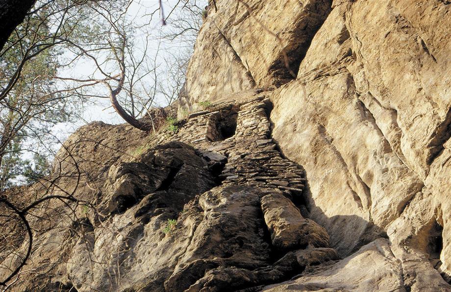
Thayatal NP

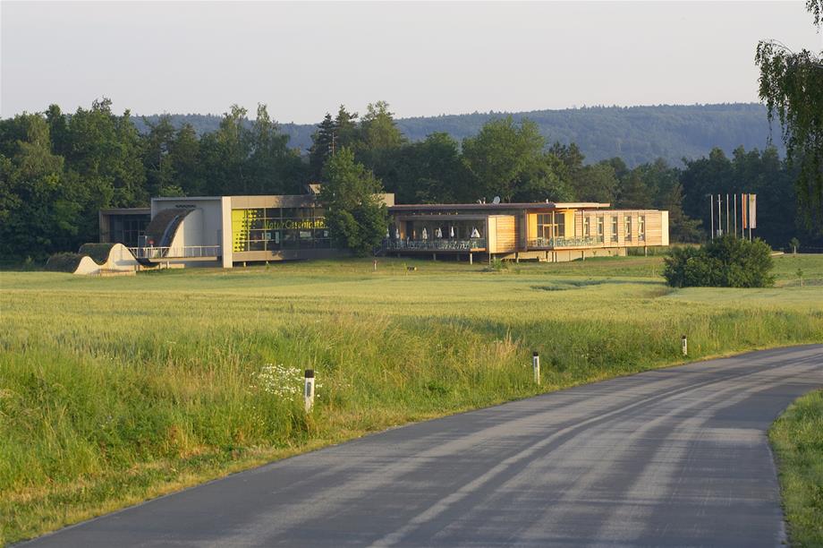
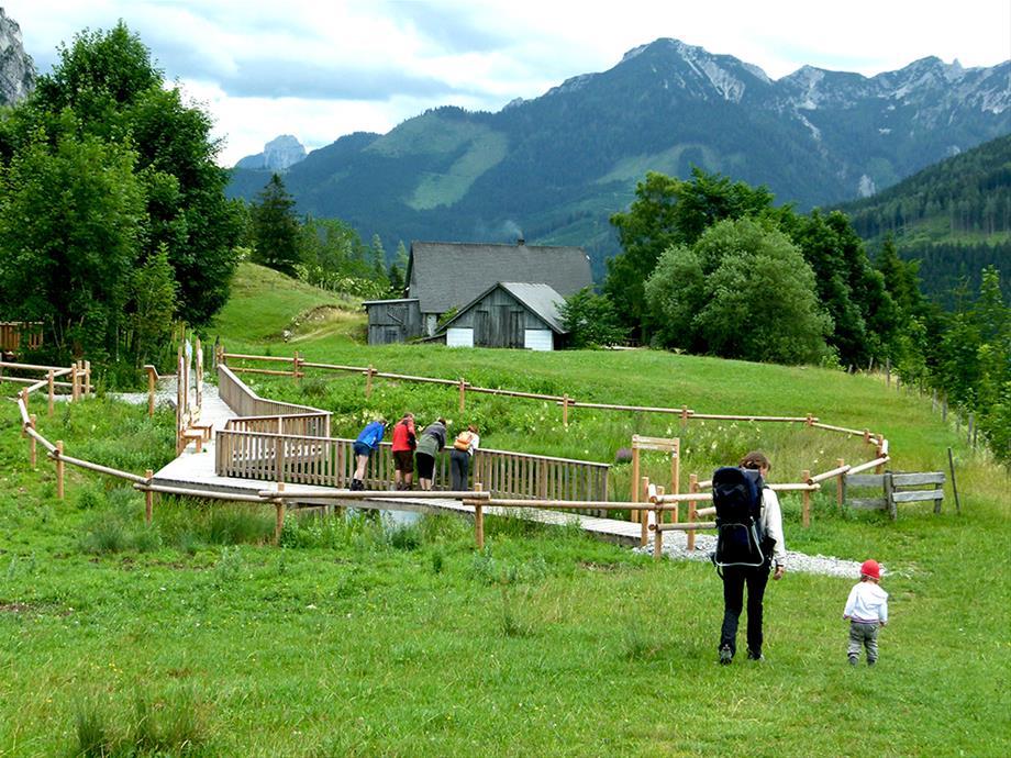
Hardegg National Park Centre
The National Park Centre is the first point of call for visitors. At the information point, there are hiking guides, hiking maps, nature information, the current events programme as well as information on tourist offerings in the region surrounding the national park.
The core of the visitor centre is the multimedia and multilingual exhibition "Natur-Geschichten”. It takes you through a journey of discovery through the valley landscape of Thaya. The huge aerial image invites you to experience the valley in its full glory and study it in every detail.
The national park shop, the café restaurant, the large adventure playground, the natural science workshop and the caravan parking area complete the service facilities for visitors.
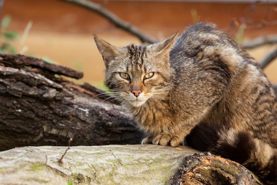

Wildcat enclosure with Frieda & Carlo
They are considered to be extinct in Austria, but they were rediscovered in the Thayatal National Park. Visit the two wildcats Frieda and Carlo in their large viewing enclosure in the National Park Centre. Our wildcat facility is the largest in Austria at 450 m², thanks to the incorporation of the adjacent woodland.
You can observe the animals climbing, lazing around and searching for food in the compound from the foyer and the event hall of the National Park Centre. The feeding shows are a highlight for visitors. Following a film projection on the biology of wildcats and a brief introduction, a national park ranger enters the enclosed area of the facility and hides some pieces of food. The two wildcats are then allowed to enter and the visitors experience the skill with which Frieda and Carlo seek out the pieces of food and the power, elegance and speed with which they climb the shrubs and trees.
Hiking routes
Thayatal trail 1
Walking time: 2 hours/6 kilometres or 3 hours/9.5 km for a circuit
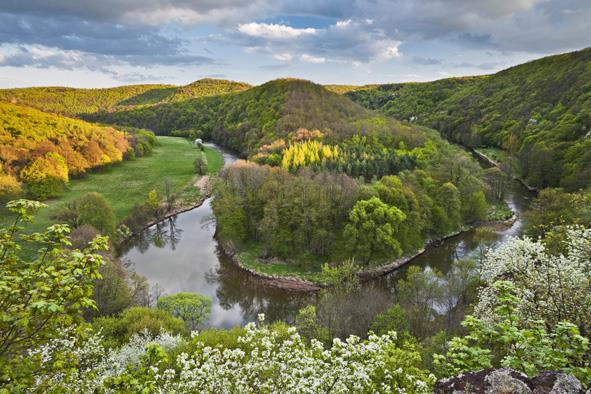
The trail leads over long distances along the Thaya to the Umlaufberg, one of the most impressive parts of the national park, as well as through untouched nature and delightful landscapes. Admittedly, the route has some steeper trail sections. Sturdy footwear and endurance are required. The hike can be started in Hardegg or in Merkersdorf. The return trail most runs on a bicycle and footpath (not included in the walking time, duration: 1 hour/4 km).
Beginning in Hardegg, the Thaya bridge is the starting point. The trail becomes easier after the steep ascent over the Gabrielensteig. Einsiedler trail 2 forks left at the trail crossing.
The Thayatal trail then goes downhill again. Even in high summer, it is pleasantly cool by the Thaya. Very rare yews are scattered around here. A short distance after the hillside footbridge, the Merkersdorf circular route 4 turns right and makes a steep ascent.
The trail splits at the first fishing huts. Toward the right, uphill, the shorter alternative leads to the crossing, an observation point. It is fascinating how the narrow river bends form two facing meander cut-offs. The Neuhäusel ruins can be seen only approx. 1.3 km upstream on the Czech side.
The trail around the meander cut-off along Thaya 1a is easier (walking time: 1 hour/3.5 km). The meadows and forests alternate and hikers are accompanied by the noise of the water.
The trails meet again below the crossing. The ruins of Neuhäusel can be seen once again, this time downstream, at the mouth of the Kajabach. In the Kajabach moat by the bridge, a shortcut to the parking area turns right, or straight ahead there is a forest road by the ruins of Kaja to Merkersdorf (Kaja trail 5). Hiking trail 630 turns towards Retz before the ruins.

Einsiedler trail 2
Walking time: 2.5 hours/5 km
At the entrance to the National Park Centre, you cross the Landesstraße and reach the edge of the forest via a track. The national park begins here, and a forest road leads you to the middle of nature. Part of the trail is designed as a wildcat themed trail. There, where Thayatal trail 1 crosses Einsiedler trail 2, begins a romantic hollow-way that leads to the Bärmühl meadow by the Thaya and ends at a rock face. A rock dwelling approx. 5 m in height can be seen. The legend tells of a hermit who lived here at the time of the crusades and helped the Hardegg habitants to a silver mine. The trail goes back along the hollow-way for a short distance, a steep path turns right and uphill and passes through oak and hornbeam populations. Two observation points boast the impressive river landscape of Thaya. The Einsiedler trail joins Thayatal trail 1 again at a fork. The trail descends down to Hardegg over the steep Gabrielensteig. You will arrive back at the National Park Centre via the Kirchensteig, which starts behind the fire station or opposite the parking area of the Hardegg castle.
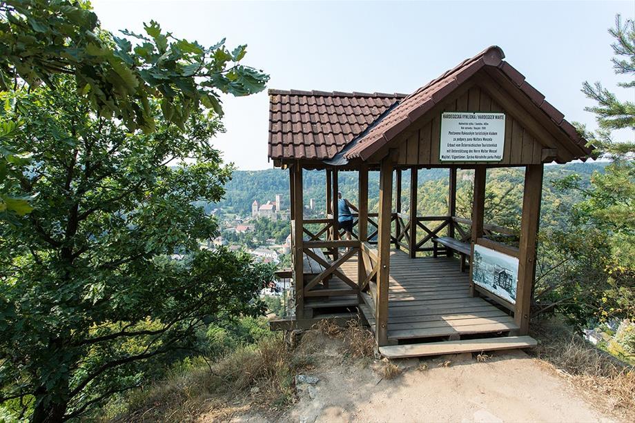
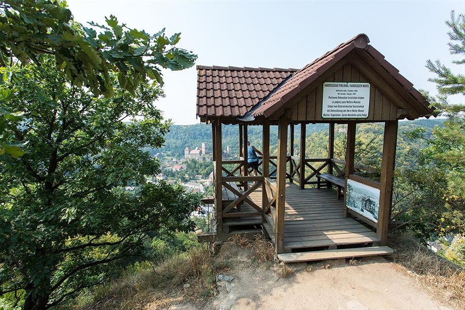
Hardegg observation tower Hardeggská vyhlídka A
Walking time: 1.5 hours/4 km
The Hardegg observation tower can be found high above Hardegg on the Czech side. Roughly 25 km after the border post, a marked path forks left which leads through the forest to Thaya. From here, you can enjoy the view of Hardegg over the dam. The natural vegetation in this stretch was virtually untouched during the time of the Iron Curtain. Some concrete bunkers are evidence of the previous fortification. In one , the trail turns right and leads through the forest on the high plain to an asphalted road.
It turns left towards Čížov (1 km), where the information point of the Czech national park Podyjí is located and a relict from the Iron Curtain remains. A right turn will take you back to Hardegg. After 1 km, a path branches off to the Hardegg observation point. This view of Thayatal and Hardegg is not to be missed. Once you are back on the road, it makes a steep ascent to the national border.